You are here: Home > Network List > US - United States National Seismic Network Stations List
> Station HAWA Hanford, Washington, USA > Earthquake Result Viewer
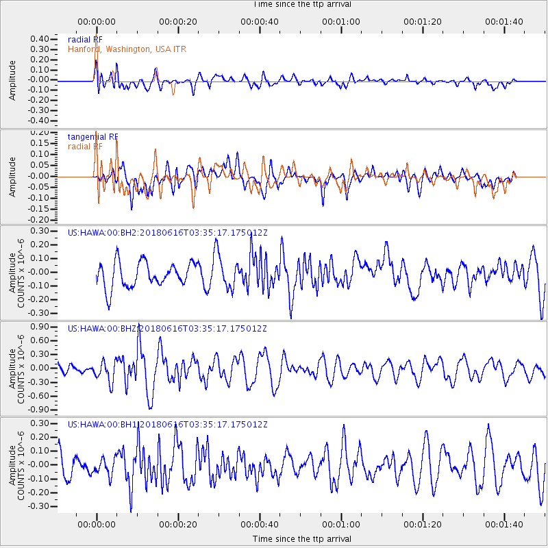
HAWA Hanford, Washington, USA - Earthquake Result Viewer
*The percent match for this event was below the threshold and hence no stack was calculated.
| Earthquake location: |
Fiji Islands Region |
| Earthquake latitude/longitude: |
-16.2/-177.6 |
| Earthquake time(UTC): |
2018/06/16 (167) 03:23:32 GMT |
| Earthquake Depth: |
10 km |
| Earthquake Magnitude: |
5.5 mb |
| Earthquake Catalog/Contributor: |
NEIC PDE/us |
|
| Network: |
US United States National Seismic Network |
| Station: |
HAWA Hanford, Washington, USA |
| Lat/Lon: |
46.39 N/119.53 W |
| Elevation: |
364 m |
|
| Distance: |
81.3 deg |
| Az: |
36.459 deg |
| Baz: |
235.559 deg |
| Ray Param: |
$rayparam |
*The percent match for this event was below the threshold and hence was not used in the summary stack. |
|
| Radial Match: |
61.193893 % |
| Radial Bump: |
400 |
| Transverse Match: |
42.04256 % |
| Transverse Bump: |
400 |
| SOD ConfigId: |
2709371 |
| Insert Time: |
2018-06-30 03:30:33.651 +0000 |
| GWidth: |
2.5 |
| Max Bumps: |
400 |
| Tol: |
0.001 |
|
Signal To Noise
| Channel | StoN | STA | LTA |
| US:HAWA:00:BHZ:20180616T03:35:17.175012Z | 1.8415638 | 2.2488105E-7 | 1.2211417E-7 |
| US:HAWA:00:BH1:20180616T03:35:17.175012Z | 0.8661798 | 6.058734E-8 | 6.994776E-8 |
| US:HAWA:00:BH2:20180616T03:35:17.175012Z | 1.4197897 | 1.2902652E-7 | 9.08772E-8 |
| Arrivals |
| Ps | |
| PpPs | |
| PsPs/PpSs | |


