You are here: Home > Network List > US - United States National Seismic Network Stations List
> Station LAO LASA Array, Montana, USA > Earthquake Result Viewer
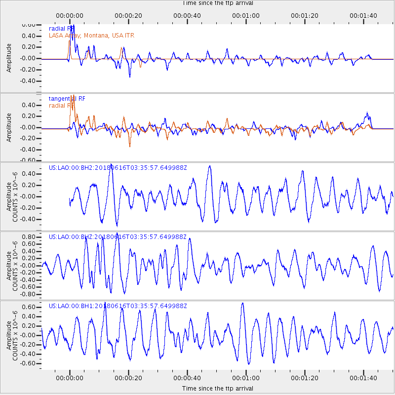
LAO LASA Array, Montana, USA - Earthquake Result Viewer
*The percent match for this event was below the threshold and hence no stack was calculated.
| Earthquake location: |
Fiji Islands Region |
| Earthquake latitude/longitude: |
-16.2/-177.6 |
| Earthquake time(UTC): |
2018/06/16 (167) 03:23:32 GMT |
| Earthquake Depth: |
10 km |
| Earthquake Magnitude: |
5.5 mb |
| Earthquake Catalog/Contributor: |
NEIC PDE/us |
|
| Network: |
US United States National Seismic Network |
| Station: |
LAO LASA Array, Montana, USA |
| Lat/Lon: |
46.69 N/106.22 W |
| Elevation: |
902 m |
|
| Distance: |
89.5 deg |
| Az: |
40.724 deg |
| Baz: |
245.553 deg |
| Ray Param: |
$rayparam |
*The percent match for this event was below the threshold and hence was not used in the summary stack. |
|
| Radial Match: |
73.54932 % |
| Radial Bump: |
328 |
| Transverse Match: |
62.378258 % |
| Transverse Bump: |
400 |
| SOD ConfigId: |
2709371 |
| Insert Time: |
2018-06-30 03:30:41.501 +0000 |
| GWidth: |
2.5 |
| Max Bumps: |
400 |
| Tol: |
0.001 |
|
Signal To Noise
| Channel | StoN | STA | LTA |
| US:LAO:00:BHZ:20180616T03:35:57.649988Z | 1.9720204 | 2.4248968E-7 | 1.2296509E-7 |
| US:LAO:00:BH1:20180616T03:35:57.649988Z | 1.9664289 | 2.535987E-7 | 1.2896409E-7 |
| US:LAO:00:BH2:20180616T03:35:57.649988Z | 0.52593 | 1.1741677E-7 | 2.2325551E-7 |
| Arrivals |
| Ps | |
| PpPs | |
| PsPs/PpSs | |


