You are here: Home > Network List > CN - Canadian National Seismograph Network Stations List
> Station INK INUVIK, NT > Earthquake Result Viewer
INK INUVIK, NT - Earthquake Result Viewer
*The percent match for this event was below the threshold and hence no stack was calculated.
| Earthquake location: |
Fiji Islands Region |
| Earthquake latitude/longitude: |
-19.1/-176.3 |
| Earthquake time(UTC): |
2022/01/27 (027) 06:40:05 GMT |
| Earthquake Depth: |
4.2 km |
| Earthquake Magnitude: |
6.2 mww |
| Earthquake Catalog/Contributor: |
NEIC PDE/us |
|
| Network: |
CN Canadian National Seismograph Network |
| Station: |
INK INUVIK, NT |
| Lat/Lon: |
68.31 N/133.53 W |
| Elevation: |
44 m |
|
| Distance: |
92.5 deg |
| Az: |
14.653 deg |
| Baz: |
220.055 deg |
| Ray Param: |
$rayparam |
*The percent match for this event was below the threshold and hence was not used in the summary stack. |
|
| Radial Match: |
65.39034 % |
| Radial Bump: |
363 |
| Transverse Match: |
64.839584 % |
| Transverse Bump: |
400 |
| SOD ConfigId: |
26694651 |
| Insert Time: |
2022-02-10 06:48:24.495 +0000 |
| GWidth: |
2.5 |
| Max Bumps: |
400 |
| Tol: |
0.001 |
|
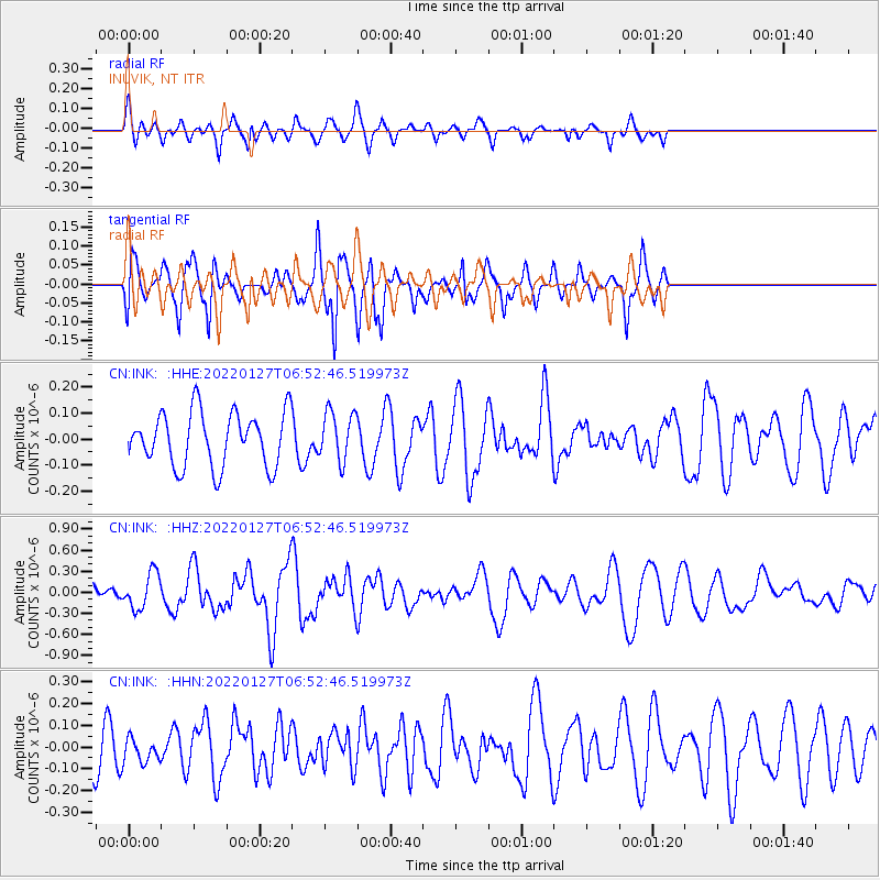
Signal To Noise
| Channel | StoN | STA | LTA |
| CN:INK: :HHZ:20220127T06:52:46.519973Z | 2.5571065 | 2.5401656E-7 | 9.933749E-8 |
| CN:INK: :HHN:20220127T06:52:46.519973Z | 0.6186857 | 5.391822E-8 | 8.7149616E-8 |
| CN:INK: :HHE:20220127T06:52:46.519973Z | 0.9065407 | 9.418468E-8 | 1.038946E-7 |
| Arrivals |
| Ps | |
| PpPs | |
| PsPs/PpSs | |


