You are here: Home > Network List > GS - US Geological Survey Networks Stations List
> Station OK031 S. Brethren Rd., Cushing, OK, USA > Earthquake Result Viewer
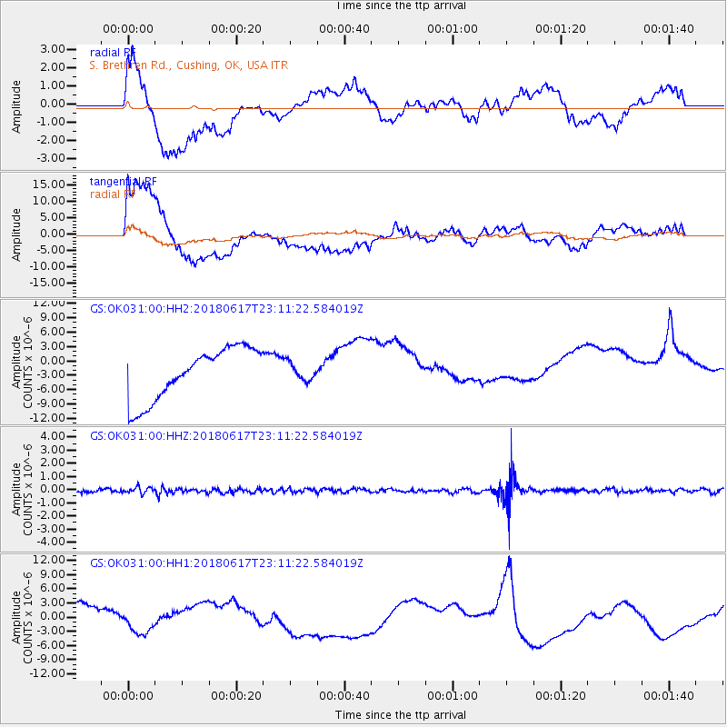
OK031 S. Brethren Rd., Cushing, OK, USA - Earthquake Result Viewer
*The percent match for this event was below the threshold and hence no stack was calculated.
| Earthquake location: |
Near S. Coast Of Western Honshu |
| Earthquake latitude/longitude: |
34.8/135.6 |
| Earthquake time(UTC): |
2018/06/17 (168) 22:58:35 GMT |
| Earthquake Depth: |
11 km |
| Earthquake Magnitude: |
5.5 Mww |
| Earthquake Catalog/Contributor: |
NEIC PDE/us |
|
| Network: |
GS US Geological Survey Networks |
| Station: |
OK031 S. Brethren Rd., Cushing, OK, USA |
| Lat/Lon: |
35.95 N/96.84 W |
| Elevation: |
290 m |
|
| Distance: |
94.3 deg |
| Az: |
40.171 deg |
| Baz: |
319.155 deg |
| Ray Param: |
$rayparam |
*The percent match for this event was below the threshold and hence was not used in the summary stack. |
|
| Radial Match: |
51.125927 % |
| Radial Bump: |
400 |
| Transverse Match: |
61.028526 % |
| Transverse Bump: |
400 |
| SOD ConfigId: |
2709371 |
| Insert Time: |
2018-07-01 23:00:14.698 +0000 |
| GWidth: |
2.5 |
| Max Bumps: |
400 |
| Tol: |
0.001 |
|
Signal To Noise
| Channel | StoN | STA | LTA |
| GS:OK031:00:HHZ:20180617T23:11:22.584019Z | 2.1267853 | 2.4349148E-7 | 1.1448805E-7 |
| GS:OK031:00:HH1:20180617T23:11:22.584019Z | 0.25486284 | 1.5087264E-6 | 5.9197587E-6 |
| GS:OK031:00:HH2:20180617T23:11:22.584019Z | 0.3323503 | 1.7907801E-6 | 5.3882304E-6 |
| Arrivals |
| Ps | |
| PpPs | |
| PsPs/PpSs | |


