You are here: Home > Network List > TA - USArray Transportable Network (new EarthScope stations) Stations List
> Station TOLK Toolik Lake Research Station, AK, USA > Earthquake Result Viewer
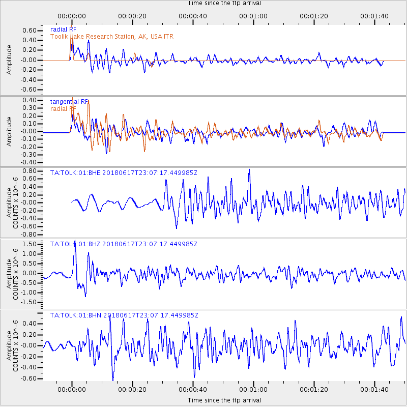
TOLK Toolik Lake Research Station, AK, USA - Earthquake Result Viewer
*The percent match for this event was below the threshold and hence no stack was calculated.
| Earthquake location: |
Near S. Coast Of Western Honshu |
| Earthquake latitude/longitude: |
34.8/135.6 |
| Earthquake time(UTC): |
2018/06/17 (168) 22:58:35 GMT |
| Earthquake Depth: |
11 km |
| Earthquake Magnitude: |
5.5 Mww |
| Earthquake Catalog/Contributor: |
NEIC PDE/us |
|
| Network: |
TA USArray Transportable Network (new EarthScope stations) |
| Station: |
TOLK Toolik Lake Research Station, AK, USA |
| Lat/Lon: |
68.64 N/149.57 W |
| Elevation: |
760 m |
|
| Distance: |
52.6 deg |
| Az: |
26.443 deg |
| Baz: |
270.563 deg |
| Ray Param: |
$rayparam |
*The percent match for this event was below the threshold and hence was not used in the summary stack. |
|
| Radial Match: |
72.539665 % |
| Radial Bump: |
400 |
| Transverse Match: |
66.652054 % |
| Transverse Bump: |
400 |
| SOD ConfigId: |
2709371 |
| Insert Time: |
2018-07-01 23:03:00.316 +0000 |
| GWidth: |
2.5 |
| Max Bumps: |
400 |
| Tol: |
0.001 |
|
Signal To Noise
| Channel | StoN | STA | LTA |
| TA:TOLK:01:BHZ:20180617T23:07:17.449985Z | 6.9318333 | 7.4819195E-7 | 1.07935655E-7 |
| TA:TOLK:01:BHN:20180617T23:07:17.449985Z | 1.4994802 | 9.390503E-8 | 6.262505E-8 |
| TA:TOLK:01:BHE:20180617T23:07:17.449985Z | 2.835231 | 2.9095244E-7 | 1.0262037E-7 |
| Arrivals |
| Ps | |
| PpPs | |
| PsPs/PpSs | |


