You are here: Home > Network List > US - United States National Seismic Network Stations List
> Station GLMI Grayling, Michigan, USA > Earthquake Result Viewer
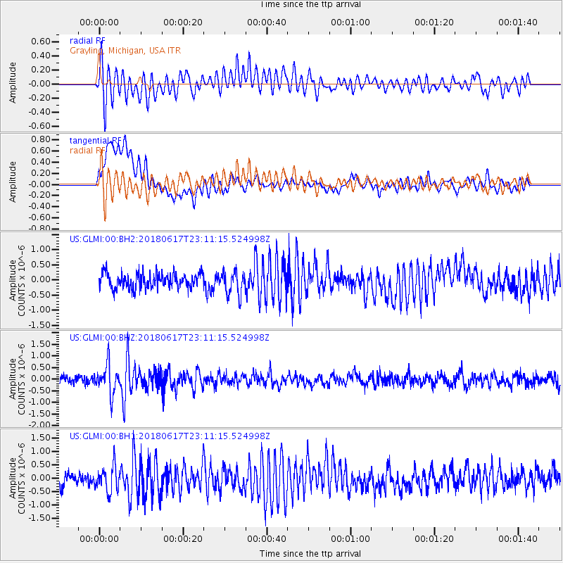
GLMI Grayling, Michigan, USA - Earthquake Result Viewer
*The percent match for this event was below the threshold and hence no stack was calculated.
| Earthquake location: |
Near S. Coast Of Western Honshu |
| Earthquake latitude/longitude: |
34.8/135.6 |
| Earthquake time(UTC): |
2018/06/17 (168) 22:58:35 GMT |
| Earthquake Depth: |
11 km |
| Earthquake Magnitude: |
5.5 Mww |
| Earthquake Catalog/Contributor: |
NEIC PDE/us |
|
| Network: |
US United States National Seismic Network |
| Station: |
GLMI Grayling, Michigan, USA |
| Lat/Lon: |
44.82 N/84.62 W |
| Elevation: |
387 m |
|
| Distance: |
92.7 deg |
| Az: |
27.395 deg |
| Baz: |
327.867 deg |
| Ray Param: |
$rayparam |
*The percent match for this event was below the threshold and hence was not used in the summary stack. |
|
| Radial Match: |
76.35006 % |
| Radial Bump: |
400 |
| Transverse Match: |
74.58224 % |
| Transverse Bump: |
400 |
| SOD ConfigId: |
2709371 |
| Insert Time: |
2018-07-01 23:04:26.882 +0000 |
| GWidth: |
2.5 |
| Max Bumps: |
400 |
| Tol: |
0.001 |
|
Signal To Noise
| Channel | StoN | STA | LTA |
| US:GLMI:00:BHZ:20180617T23:11:15.524998Z | 4.425628 | 6.4187736E-7 | 1.4503644E-7 |
| US:GLMI:00:BH1:20180617T23:11:15.524998Z | 2.0341816 | 4.7247931E-7 | 2.3226997E-7 |
| US:GLMI:00:BH2:20180617T23:11:15.524998Z | 1.6095738 | 3.8801957E-7 | 2.4106976E-7 |
| Arrivals |
| Ps | |
| PpPs | |
| PsPs/PpSs | |


