You are here: Home > Network List > US - United States National Seismic Network Stations List
> Station MSO Missoula, Montana, USA > Earthquake Result Viewer
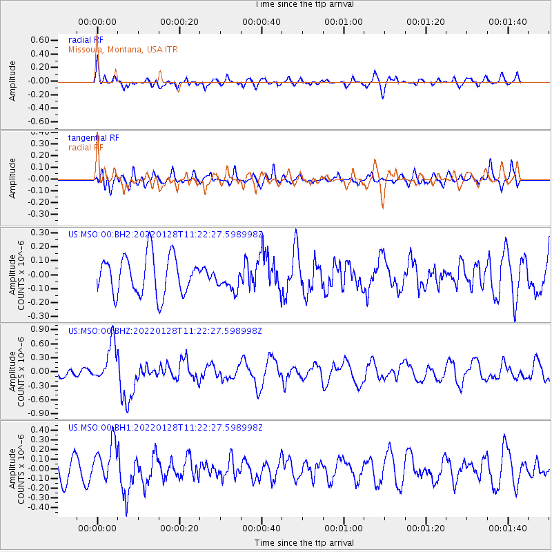
MSO Missoula, Montana, USA - Earthquake Result Viewer
*The percent match for this event was below the threshold and hence no stack was calculated.
| Earthquake location: |
South Of Panama |
| Earthquake latitude/longitude: |
5.5/-82.6 |
| Earthquake time(UTC): |
2022/01/28 (028) 11:14:09 GMT |
| Earthquake Depth: |
10 km |
| Earthquake Magnitude: |
6.1 mww |
| Earthquake Catalog/Contributor: |
NEIC PDE/us |
|
| Network: |
US United States National Seismic Network |
| Station: |
MSO Missoula, Montana, USA |
| Lat/Lon: |
46.83 N/113.94 W |
| Elevation: |
1264 m |
|
| Distance: |
49.2 deg |
| Az: |
331.862 deg |
| Baz: |
136.864 deg |
| Ray Param: |
$rayparam |
*The percent match for this event was below the threshold and hence was not used in the summary stack. |
|
| Radial Match: |
56.592655 % |
| Radial Bump: |
400 |
| Transverse Match: |
40.18793 % |
| Transverse Bump: |
400 |
| SOD ConfigId: |
26694651 |
| Insert Time: |
2022-02-11 11:40:20.784 +0000 |
| GWidth: |
2.5 |
| Max Bumps: |
400 |
| Tol: |
0.001 |
|
Signal To Noise
| Channel | StoN | STA | LTA |
| US:MSO:00:BHZ:20220128T11:22:27.598998Z | 4.776003 | 4.4069404E-7 | 9.2272565E-8 |
| US:MSO:00:BH1:20220128T11:22:27.598998Z | 1.8156654 | 2.0034341E-7 | 1.1034159E-7 |
| US:MSO:00:BH2:20220128T11:22:27.598998Z | 0.61204064 | 8.4519236E-8 | 1.3809415E-7 |
| Arrivals |
| Ps | |
| PpPs | |
| PsPs/PpSs | |


