You are here: Home > Network List > US - United States National Seismic Network Stations List
> Station EGMT Eagleton, Montana, USA > Earthquake Result Viewer
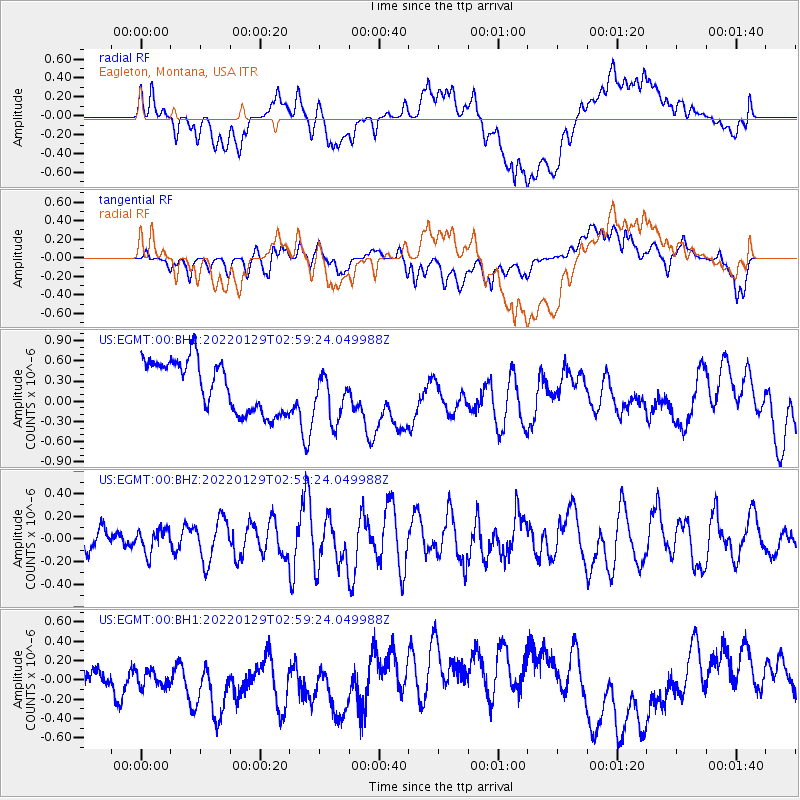
EGMT Eagleton, Montana, USA - Earthquake Result Viewer
*The percent match for this event was below the threshold and hence no stack was calculated.
| Earthquake location: |
Kermadec Islands Region |
| Earthquake latitude/longitude: |
-29.8/-174.7 |
| Earthquake time(UTC): |
2022/01/29 (029) 02:46:28 GMT |
| Earthquake Depth: |
33 km |
| Earthquake Magnitude: |
6.6 Mi |
| Earthquake Catalog/Contributor: |
NEIC PDE/pt |
|
| Network: |
US United States National Seismic Network |
| Station: |
EGMT Eagleton, Montana, USA |
| Lat/Lon: |
48.02 N/109.75 W |
| Elevation: |
1055 m |
|
| Distance: |
96.8 deg |
| Az: |
37.772 deg |
| Baz: |
232.511 deg |
| Ray Param: |
$rayparam |
*The percent match for this event was below the threshold and hence was not used in the summary stack. |
|
| Radial Match: |
38.599407 % |
| Radial Bump: |
400 |
| Transverse Match: |
36.313778 % |
| Transverse Bump: |
400 |
| SOD ConfigId: |
26694651 |
| Insert Time: |
2022-02-12 03:03:03.783 +0000 |
| GWidth: |
2.5 |
| Max Bumps: |
400 |
| Tol: |
0.001 |
|
Signal To Noise
| Channel | StoN | STA | LTA |
| US:EGMT:00:BHZ:20220129T02:59:24.049988Z | 0.985531 | 1.0264194E-7 | 1.0414888E-7 |
| US:EGMT:00:BH1:20220129T02:59:24.049988Z | 0.40047547 | 9.6837226E-8 | 2.4180562E-7 |
| US:EGMT:00:BH2:20220129T02:59:24.049988Z | 0.96821123 | 3.6761983E-7 | 3.796897E-7 |
| Arrivals |
| Ps | |
| PpPs | |
| PsPs/PpSs | |


