You are here: Home > Network List > NE - New England Seismic Network Stations List
> Station EMMW Machias, ME, USA > Earthquake Result Viewer
EMMW Machias, ME, USA - Earthquake Result Viewer
*The percent match for this event was below the threshold and hence no stack was calculated.
| Earthquake location: |
Guatemala |
| Earthquake latitude/longitude: |
14.1/-90.7 |
| Earthquake time(UTC): |
2018/06/18 (169) 02:32:55 GMT |
| Earthquake Depth: |
98 km |
| Earthquake Magnitude: |
5.7 Mww |
| Earthquake Catalog/Contributor: |
NEIC PDE/us |
|
| Network: |
NE New England Seismic Network |
| Station: |
EMMW Machias, ME, USA |
| Lat/Lon: |
44.71 N/67.46 W |
| Elevation: |
35 m |
|
| Distance: |
36.3 deg |
| Az: |
28.375 deg |
| Baz: |
220.283 deg |
| Ray Param: |
$rayparam |
*The percent match for this event was below the threshold and hence was not used in the summary stack. |
|
| Radial Match: |
76.143196 % |
| Radial Bump: |
362 |
| Transverse Match: |
64.70112 % |
| Transverse Bump: |
400 |
| SOD ConfigId: |
2709371 |
| Insert Time: |
2018-07-02 02:34:45.287 +0000 |
| GWidth: |
2.5 |
| Max Bumps: |
400 |
| Tol: |
0.001 |
|
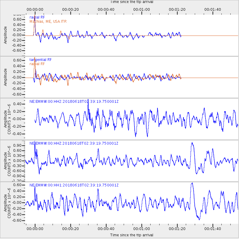
Signal To Noise
| Channel | StoN | STA | LTA |
| NE:EMMW:00:HHZ:20180618T02:39:19.750001Z | 3.2348053 | 4.300696E-7 | 1.3295069E-7 |
| NE:EMMW:00:HH1:20180618T02:39:19.750001Z | 1.3499968 | 1.8329948E-7 | 1.3577771E-7 |
| NE:EMMW:00:HH2:20180618T02:39:19.750001Z | 1.846443 | 1.8417109E-7 | 9.974371E-8 |
| Arrivals |
| Ps | |
| PpPs | |
| PsPs/PpSs | |


