You are here: Home > Network List > US - United States National Seismic Network Stations List
> Station DGMT Dagmar, Montana, USA > Earthquake Result Viewer
DGMT Dagmar, Montana, USA - Earthquake Result Viewer
*The percent match for this event was below the threshold and hence no stack was calculated.
| Earthquake location: |
Guatemala |
| Earthquake latitude/longitude: |
14.1/-90.7 |
| Earthquake time(UTC): |
2018/06/18 (169) 02:32:55 GMT |
| Earthquake Depth: |
98 km |
| Earthquake Magnitude: |
5.7 Mww |
| Earthquake Catalog/Contributor: |
NEIC PDE/us |
|
| Network: |
US United States National Seismic Network |
| Station: |
DGMT Dagmar, Montana, USA |
| Lat/Lon: |
48.47 N/104.20 W |
| Elevation: |
0.0 m |
|
| Distance: |
36.0 deg |
| Az: |
344.697 deg |
| Baz: |
157.373 deg |
| Ray Param: |
$rayparam |
*The percent match for this event was below the threshold and hence was not used in the summary stack. |
|
| Radial Match: |
37.91377 % |
| Radial Bump: |
261 |
| Transverse Match: |
55.25597 % |
| Transverse Bump: |
355 |
| SOD ConfigId: |
2709371 |
| Insert Time: |
2018-07-02 02:35:13.750 +0000 |
| GWidth: |
2.5 |
| Max Bumps: |
400 |
| Tol: |
0.001 |
|
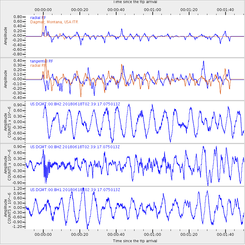
Signal To Noise
| Channel | StoN | STA | LTA |
| US:DGMT:00:BHZ:20180618T02:39:17.075013Z | 1.9346406 | 3.877659E-7 | 2.0043304E-7 |
| US:DGMT:00:BH1:20180618T02:39:17.075013Z | 1.3649248 | 2.8971658E-7 | 2.1225826E-7 |
| US:DGMT:00:BH2:20180618T02:39:17.075013Z | 1.0549753 | 4.721205E-7 | 4.475181E-7 |
| Arrivals |
| Ps | |
| PpPs | |
| PsPs/PpSs | |


