You are here: Home > Network List > UW - Pacific Northwest Regional Seismic Network Stations List
> Station UMAT Pilot Rock, OR, USA > Earthquake Result Viewer
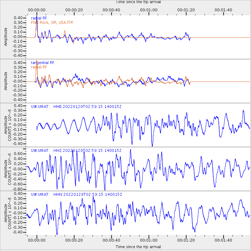
UMAT Pilot Rock, OR, USA - Earthquake Result Viewer
*The percent match for this event was below the threshold and hence no stack was calculated.
| Earthquake location: |
Kermadec Islands Region |
| Earthquake latitude/longitude: |
-29.8/-174.7 |
| Earthquake time(UTC): |
2022/01/29 (029) 02:46:49 GMT |
| Earthquake Depth: |
33 km |
| Earthquake Magnitude: |
6.6 Mi |
| Earthquake Catalog/Contributor: |
NEIC PDE/at |
|
| Network: |
UW Pacific Northwest Regional Seismic Network |
| Station: |
UMAT Pilot Rock, OR, USA |
| Lat/Lon: |
45.29 N/118.96 W |
| Elevation: |
1318 m |
|
| Distance: |
90.3 deg |
| Az: |
35.692 deg |
| Baz: |
225.922 deg |
| Ray Param: |
$rayparam |
*The percent match for this event was below the threshold and hence was not used in the summary stack. |
|
| Radial Match: |
77.26222 % |
| Radial Bump: |
400 |
| Transverse Match: |
65.82625 % |
| Transverse Bump: |
400 |
| SOD ConfigId: |
26694651 |
| Insert Time: |
2022-02-12 03:41:03.591 +0000 |
| GWidth: |
2.5 |
| Max Bumps: |
400 |
| Tol: |
0.001 |
|
Signal To Noise
| Channel | StoN | STA | LTA |
| UW:UMAT: :HHZ:20220129T02:59:15.140015Z | 2.8671117 | 2.5667504E-7 | 8.95239E-8 |
| UW:UMAT: :HHN:20220129T02:59:15.140015Z | 1.7727727 | 1.3803509E-7 | 7.786395E-8 |
| UW:UMAT: :HHE:20220129T02:59:15.140015Z | 1.4285251 | 1.0344702E-7 | 7.241526E-8 |
| Arrivals |
| Ps | |
| PpPs | |
| PsPs/PpSs | |


