You are here: Home > Network List > UW - Pacific Northwest Regional Seismic Network Stations List
> Station HOOD Mt Hood Meadows, OR CREST BB SMO > Earthquake Result Viewer
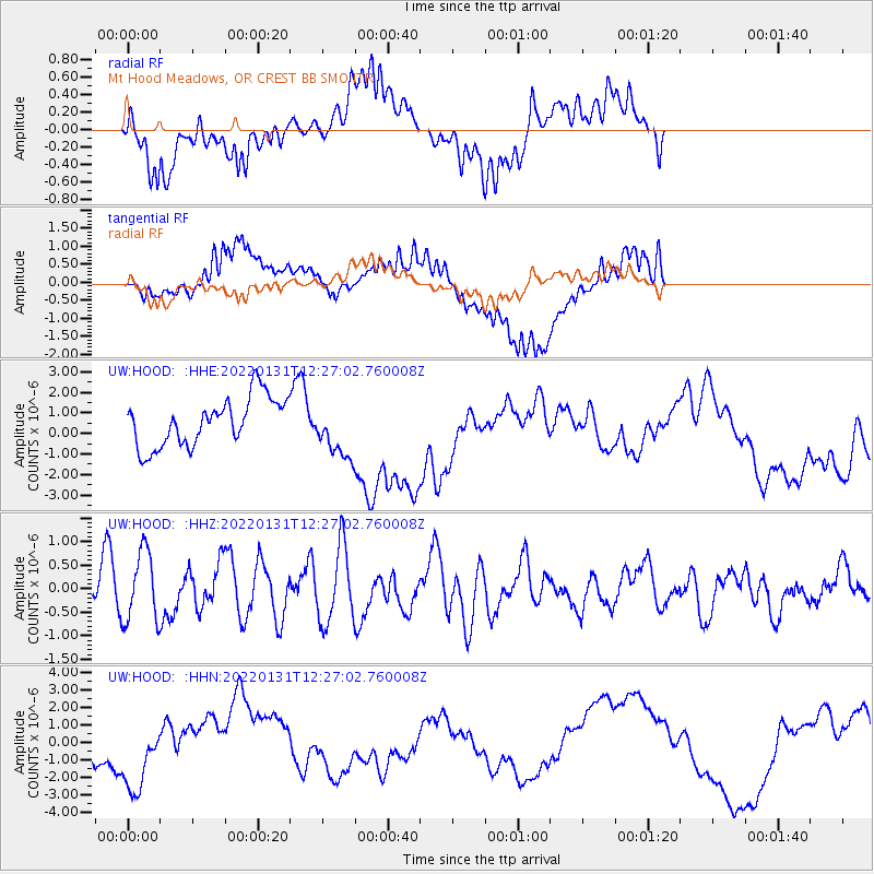
HOOD Mt Hood Meadows, OR CREST BB SMO - Earthquake Result Viewer
*The percent match for this event was below the threshold and hence no stack was calculated.
| Earthquake location: |
Kermadec Islands Region |
| Earthquake latitude/longitude: |
-29.5/-176.8 |
| Earthquake time(UTC): |
2022/01/31 (031) 12:14:35 GMT |
| Earthquake Depth: |
10 km |
| Earthquake Magnitude: |
5.8 mww |
| Earthquake Catalog/Contributor: |
NEIC PDE/us |
|
| Network: |
UW Pacific Northwest Regional Seismic Network |
| Station: |
HOOD Mt Hood Meadows, OR CREST BB SMO |
| Lat/Lon: |
45.32 N/121.65 W |
| Elevation: |
1520 m |
|
| Distance: |
89.8 deg |
| Az: |
35.37 deg |
| Baz: |
225.649 deg |
| Ray Param: |
$rayparam |
*The percent match for this event was below the threshold and hence was not used in the summary stack. |
|
| Radial Match: |
51.74313 % |
| Radial Bump: |
400 |
| Transverse Match: |
59.72259 % |
| Transverse Bump: |
400 |
| SOD ConfigId: |
26694651 |
| Insert Time: |
2022-02-14 12:30:36.119 +0000 |
| GWidth: |
2.5 |
| Max Bumps: |
400 |
| Tol: |
0.001 |
|
Signal To Noise
| Channel | StoN | STA | LTA |
| UW:HOOD: :HHZ:20220131T12:27:02.760008Z | 1.6842237 | 7.504525E-7 | 4.4557768E-7 |
| UW:HOOD: :HHN:20220131T12:27:02.760008Z | 2.1702464 | 2.1306948E-6 | 9.817755E-7 |
| UW:HOOD: :HHE:20220131T12:27:02.760008Z | 1.143964 | 1.3357233E-6 | 1.1676269E-6 |
| Arrivals |
| Ps | |
| PpPs | |
| PsPs/PpSs | |


