You are here: Home > Network List > US - United States National Seismic Network Stations List
> Station HAWA Hanford, Washington, USA > Earthquake Result Viewer
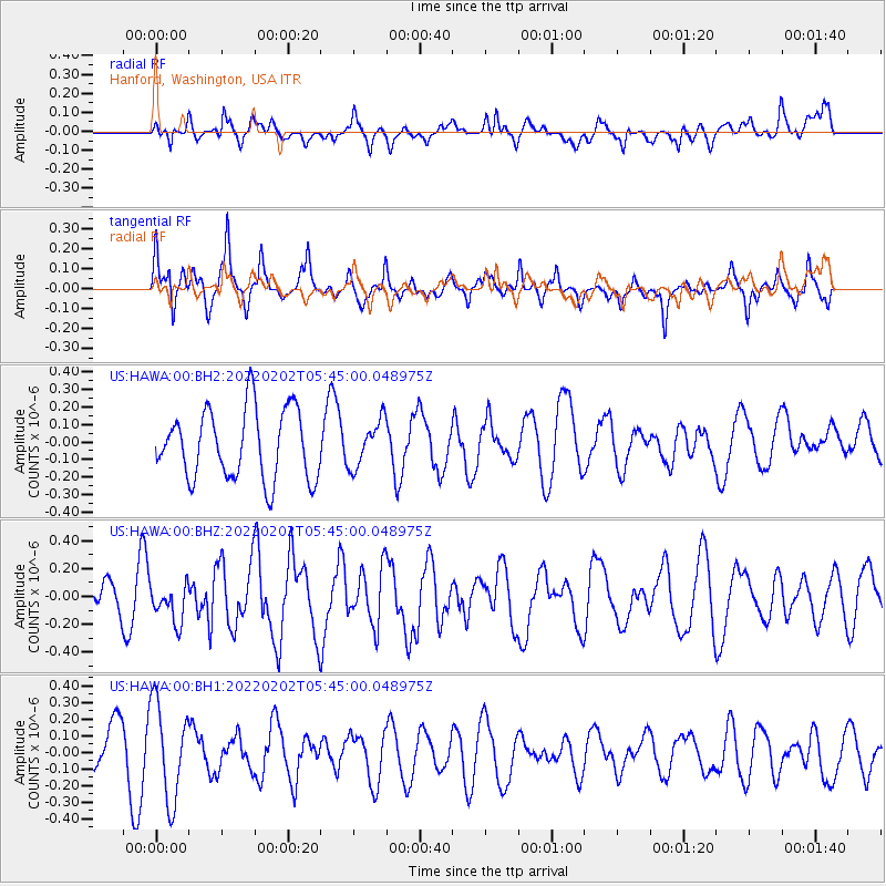
HAWA Hanford, Washington, USA - Earthquake Result Viewer
*The percent match for this event was below the threshold and hence no stack was calculated.
| Earthquake location: |
Kermadec Islands Region |
| Earthquake latitude/longitude: |
-27.8/-176.4 |
| Earthquake time(UTC): |
2022/02/02 (033) 05:32:32 GMT |
| Earthquake Depth: |
10 km |
| Earthquake Magnitude: |
5.5 mww |
| Earthquake Catalog/Contributor: |
NEIC PDE/us |
|
| Network: |
US United States National Seismic Network |
| Station: |
HAWA Hanford, Washington, USA |
| Lat/Lon: |
46.39 N/119.53 W |
| Elevation: |
364 m |
|
| Distance: |
90.0 deg |
| Az: |
35.4 deg |
| Baz: |
227.852 deg |
| Ray Param: |
$rayparam |
*The percent match for this event was below the threshold and hence was not used in the summary stack. |
|
| Radial Match: |
56.419514 % |
| Radial Bump: |
400 |
| Transverse Match: |
68.07907 % |
| Transverse Bump: |
356 |
| SOD ConfigId: |
26694651 |
| Insert Time: |
2022-02-16 05:49:16.361 +0000 |
| GWidth: |
2.5 |
| Max Bumps: |
400 |
| Tol: |
0.001 |
|
Signal To Noise
| Channel | StoN | STA | LTA |
| US:HAWA:00:BHZ:20220202T05:45:00.048975Z | 0.90168387 | 1.3133288E-7 | 1.4565292E-7 |
| US:HAWA:00:BH1:20220202T05:45:00.048975Z | 2.4210403 | 2.893771E-7 | 1.1952594E-7 |
| US:HAWA:00:BH2:20220202T05:45:00.048975Z | 0.6665186 | 1.3258263E-7 | 1.9891812E-7 |
| Arrivals |
| Ps | |
| PpPs | |
| PsPs/PpSs | |


