You are here: Home > Network List > US - United States National Seismic Network Stations List
> Station MNTX Cornudas Mountains, Texas, USA > Earthquake Result Viewer
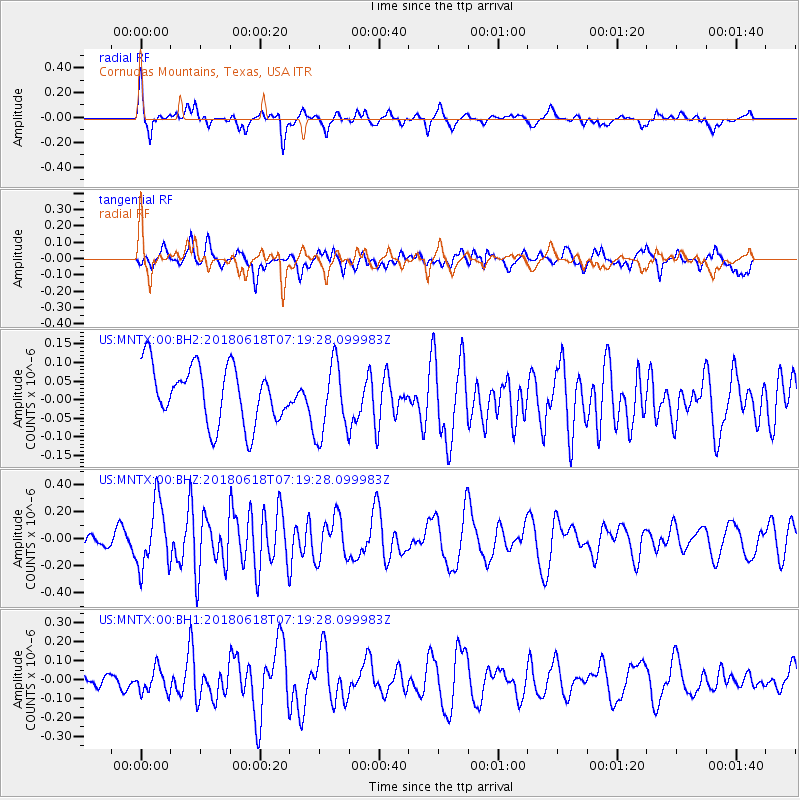
MNTX Cornudas Mountains, Texas, USA - Earthquake Result Viewer
*The percent match for this event was below the threshold and hence no stack was calculated.
| Earthquake location: |
Easter Island Region |
| Earthquake latitude/longitude: |
-29.9/-111.9 |
| Earthquake time(UTC): |
2018/06/18 (169) 07:09:41 GMT |
| Earthquake Depth: |
10 km |
| Earthquake Magnitude: |
5.9 Mww |
| Earthquake Catalog/Contributor: |
NEIC PDE/us |
|
| Network: |
US United States National Seismic Network |
| Station: |
MNTX Cornudas Mountains, Texas, USA |
| Lat/Lon: |
31.70 N/105.38 W |
| Elevation: |
404 m |
|
| Distance: |
61.6 deg |
| Az: |
6.293 deg |
| Baz: |
186.409 deg |
| Ray Param: |
$rayparam |
*The percent match for this event was below the threshold and hence was not used in the summary stack. |
|
| Radial Match: |
66.06489 % |
| Radial Bump: |
400 |
| Transverse Match: |
66.000465 % |
| Transverse Bump: |
400 |
| SOD ConfigId: |
2709371 |
| Insert Time: |
2018-07-02 07:17:07.022 +0000 |
| GWidth: |
2.5 |
| Max Bumps: |
400 |
| Tol: |
0.001 |
|
Signal To Noise
| Channel | StoN | STA | LTA |
| US:MNTX:00:BHZ:20180618T07:19:28.099983Z | 2.6905584 | 2.391466E-7 | 8.888363E-8 |
| US:MNTX:00:BH1:20180618T07:19:28.099983Z | 1.1377771 | 6.503095E-8 | 5.7156143E-8 |
| US:MNTX:00:BH2:20180618T07:19:28.099983Z | 1.2986238 | 9.9348746E-8 | 7.65031E-8 |
| Arrivals |
| Ps | |
| PpPs | |
| PsPs/PpSs | |


