You are here: Home > Network List > TX - Texas Seismological Network Stations List
> Station WTFS Witchita Falls > Earthquake Result Viewer
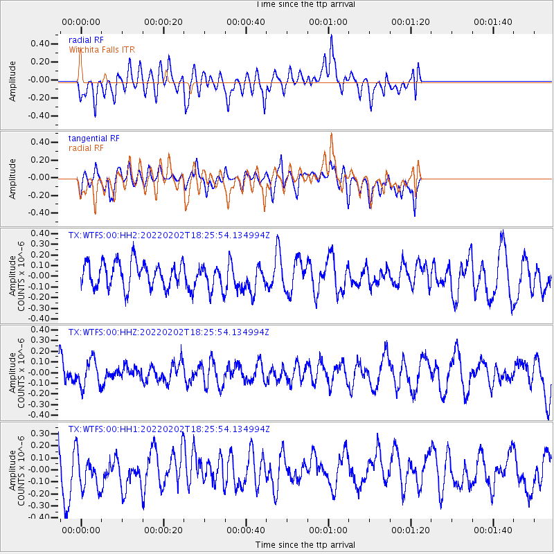
WTFS Witchita Falls - Earthquake Result Viewer
*The percent match for this event was below the threshold and hence no stack was calculated.
| Earthquake location: |
Kermadec Islands Region |
| Earthquake latitude/longitude: |
-28.1/-175.6 |
| Earthquake time(UTC): |
2022/02/02 (033) 18:13:01 GMT |
| Earthquake Depth: |
10 km |
| Earthquake Magnitude: |
5.5 Mww |
| Earthquake Catalog/Contributor: |
NEIC PDE/us |
|
| Network: |
TX Texas Seismological Network |
| Station: |
WTFS Witchita Falls |
| Lat/Lon: |
33.77 N/98.46 W |
| Elevation: |
277 m |
|
| Distance: |
95.5 deg |
| Az: |
54.666 deg |
| Baz: |
239.905 deg |
| Ray Param: |
$rayparam |
*The percent match for this event was below the threshold and hence was not used in the summary stack. |
|
| Radial Match: |
50.876415 % |
| Radial Bump: |
400 |
| Transverse Match: |
37.115948 % |
| Transverse Bump: |
400 |
| SOD ConfigId: |
26694651 |
| Insert Time: |
2022-02-16 18:29:56.402 +0000 |
| GWidth: |
2.5 |
| Max Bumps: |
400 |
| Tol: |
0.001 |
|
Signal To Noise
| Channel | StoN | STA | LTA |
| TX:WTFS:00:HHZ:20220202T18:25:54.134994Z | 1.1316817 | 1.2675771E-7 | 1.1200827E-7 |
| TX:WTFS:00:HH1:20220202T18:25:54.134994Z | 1.0677447 | 1.5329765E-7 | 1.4357144E-7 |
| TX:WTFS:00:HH2:20220202T18:25:54.134994Z | 1.0266671 | 1.1952879E-7 | 1.164241E-7 |
| Arrivals |
| Ps | |
| PpPs | |
| PsPs/PpSs | |


