You are here: Home > Network List > US - United States National Seismic Network Stations List
> Station MNTX Cornudas Mountains, Texas, USA > Earthquake Result Viewer
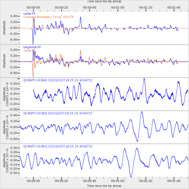
MNTX Cornudas Mountains, Texas, USA - Earthquake Result Viewer
*The percent match for this event was below the threshold and hence no stack was calculated.
| Earthquake location: |
Kermadec Islands Region |
| Earthquake latitude/longitude: |
-28.1/-175.6 |
| Earthquake time(UTC): |
2022/02/02 (033) 18:13:01 GMT |
| Earthquake Depth: |
10 km |
| Earthquake Magnitude: |
5.5 Mww |
| Earthquake Catalog/Contributor: |
NEIC PDE/us |
|
| Network: |
US United States National Seismic Network |
| Station: |
MNTX Cornudas Mountains, Texas, USA |
| Lat/Lon: |
31.70 N/105.38 W |
| Elevation: |
405 m |
|
| Distance: |
89.4 deg |
| Az: |
53.329 deg |
| Baz: |
236.236 deg |
| Ray Param: |
$rayparam |
*The percent match for this event was below the threshold and hence was not used in the summary stack. |
|
| Radial Match: |
35.461456 % |
| Radial Bump: |
400 |
| Transverse Match: |
46.912952 % |
| Transverse Bump: |
400 |
| SOD ConfigId: |
26694651 |
| Insert Time: |
2022-02-16 18:30:36.117 +0000 |
| GWidth: |
2.5 |
| Max Bumps: |
400 |
| Tol: |
0.001 |
|
Signal To Noise
| Channel | StoN | STA | LTA |
| US:MNTX:00:BHZ:20220202T18:25:26.424972Z | 0.7572464 | 5.053491E-8 | 6.6735105E-8 |
| US:MNTX:00:BH1:20220202T18:25:26.424972Z | 1.470278 | 1.1659307E-7 | 7.9300015E-8 |
| US:MNTX:00:BH2:20220202T18:25:26.424972Z | 1.8498584 | 1.3287212E-7 | 7.182826E-8 |
| Arrivals |
| Ps | |
| PpPs | |
| PsPs/PpSs | |


