You are here: Home > Network List > AZ - ANZA Regional Network Stations List
> Station SMER AZ.SMER > Earthquake Result Viewer
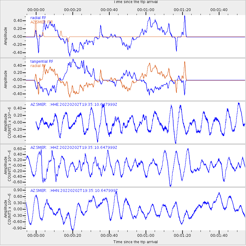
SMER AZ.SMER - Earthquake Result Viewer
*The percent match for this event was below the threshold and hence no stack was calculated.
| Earthquake location: |
South Of Kermadec Islands |
| Earthquake latitude/longitude: |
-32.2/-179.1 |
| Earthquake time(UTC): |
2022/02/02 (033) 19:23:01 GMT |
| Earthquake Depth: |
68 km |
| Earthquake Magnitude: |
5.3 Mww |
| Earthquake Catalog/Contributor: |
NEIC PDE/us |
|
| Network: |
AZ ANZA Regional Network |
| Station: |
SMER AZ.SMER |
| Lat/Lon: |
33.46 N/117.17 W |
| Elevation: |
355 m |
|
| Distance: |
87.6 deg |
| Az: |
47.56 deg |
| Baz: |
228.429 deg |
| Ray Param: |
$rayparam |
*The percent match for this event was below the threshold and hence was not used in the summary stack. |
|
| Radial Match: |
59.595062 % |
| Radial Bump: |
400 |
| Transverse Match: |
51.83908 % |
| Transverse Bump: |
400 |
| SOD ConfigId: |
26694651 |
| Insert Time: |
2022-02-16 19:27:01.443 +0000 |
| GWidth: |
2.5 |
| Max Bumps: |
400 |
| Tol: |
0.001 |
|
Signal To Noise
| Channel | StoN | STA | LTA |
| AZ:SMER: :HHZ:20220202T19:35:10.647999Z | 2.140592 | 4.0511304E-7 | 1.8925279E-7 |
| AZ:SMER: :HHN:20220202T19:35:10.647999Z | 1.1487124 | 5.0296444E-7 | 4.3785064E-7 |
| AZ:SMER: :HHE:20220202T19:35:10.647999Z | 1.9193965 | 2.9817448E-7 | 1.5534803E-7 |
| Arrivals |
| Ps | |
| PpPs | |
| PsPs/PpSs | |


