You are here: Home > Network List > AV - Alaska Volcano Observatory Stations List
> Station AMKA Regional Station, Amchitka Island, Alaska > Earthquake Result Viewer
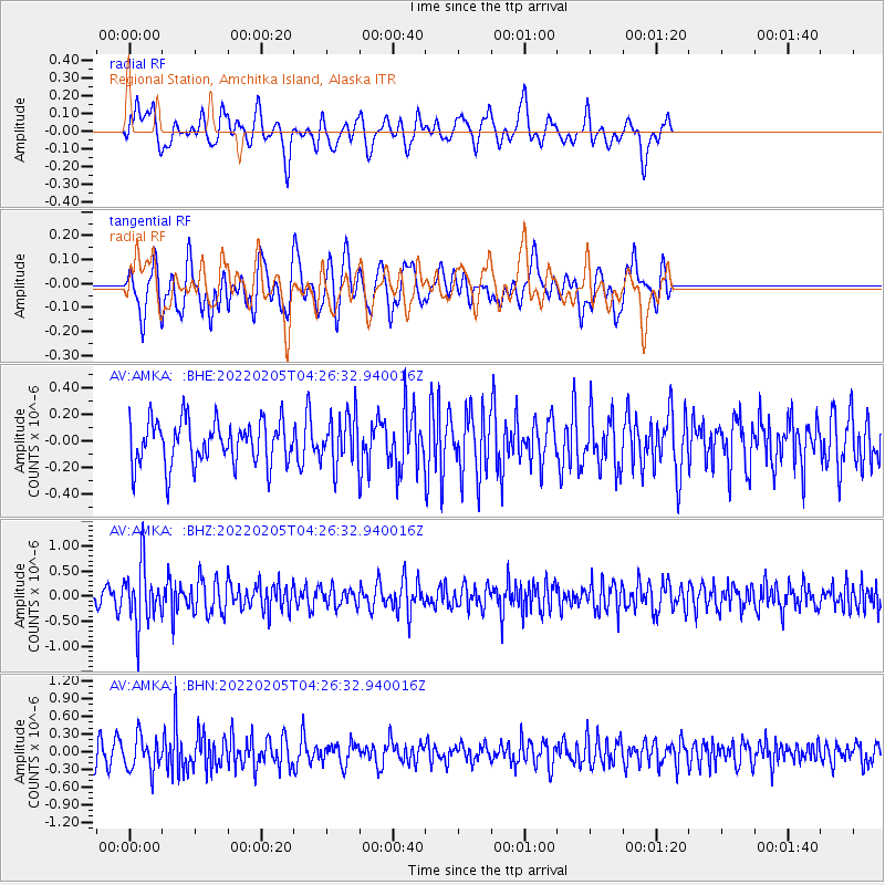
AMKA Regional Station, Amchitka Island, Alaska - Earthquake Result Viewer
*The percent match for this event was below the threshold and hence no stack was calculated.
| Earthquake location: |
Afghanistan-Tajikistan Bord Reg. |
| Earthquake latitude/longitude: |
36.4/71.1 |
| Earthquake time(UTC): |
2022/02/05 (036) 04:16:01 GMT |
| Earthquake Depth: |
209 km |
| Earthquake Magnitude: |
5.7 mww |
| Earthquake Catalog/Contributor: |
NEIC PDE/us |
|
| Network: |
AV Alaska Volcano Observatory |
| Station: |
AMKA Regional Station, Amchitka Island, Alaska |
| Lat/Lon: |
51.38 N/179.30 E |
| Elevation: |
116 m |
|
| Distance: |
72.4 deg |
| Az: |
38.67 deg |
| Baz: |
306.497 deg |
| Ray Param: |
$rayparam |
*The percent match for this event was below the threshold and hence was not used in the summary stack. |
|
| Radial Match: |
51.415108 % |
| Radial Bump: |
400 |
| Transverse Match: |
56.574802 % |
| Transverse Bump: |
400 |
| SOD ConfigId: |
26694651 |
| Insert Time: |
2022-02-19 04:22:02.628 +0000 |
| GWidth: |
2.5 |
| Max Bumps: |
400 |
| Tol: |
0.001 |
|
Signal To Noise
| Channel | StoN | STA | LTA |
| AV:AMKA: :BHZ:20220205T04:26:32.940016Z | 3.3421168 | 5.956273E-7 | 1.7821857E-7 |
| AV:AMKA: :BHN:20220205T04:26:32.940016Z | 1.6156231 | 2.868606E-7 | 1.7755417E-7 |
| AV:AMKA: :BHE:20220205T04:26:32.940016Z | 1.1602515 | 1.9040239E-7 | 1.641044E-7 |
| Arrivals |
| Ps | |
| PpPs | |
| PsPs/PpSs | |


