You are here: Home > Network List > US - United States National Seismic Network Stations List
> Station HAWA Hanford, Washington, USA > Earthquake Result Viewer
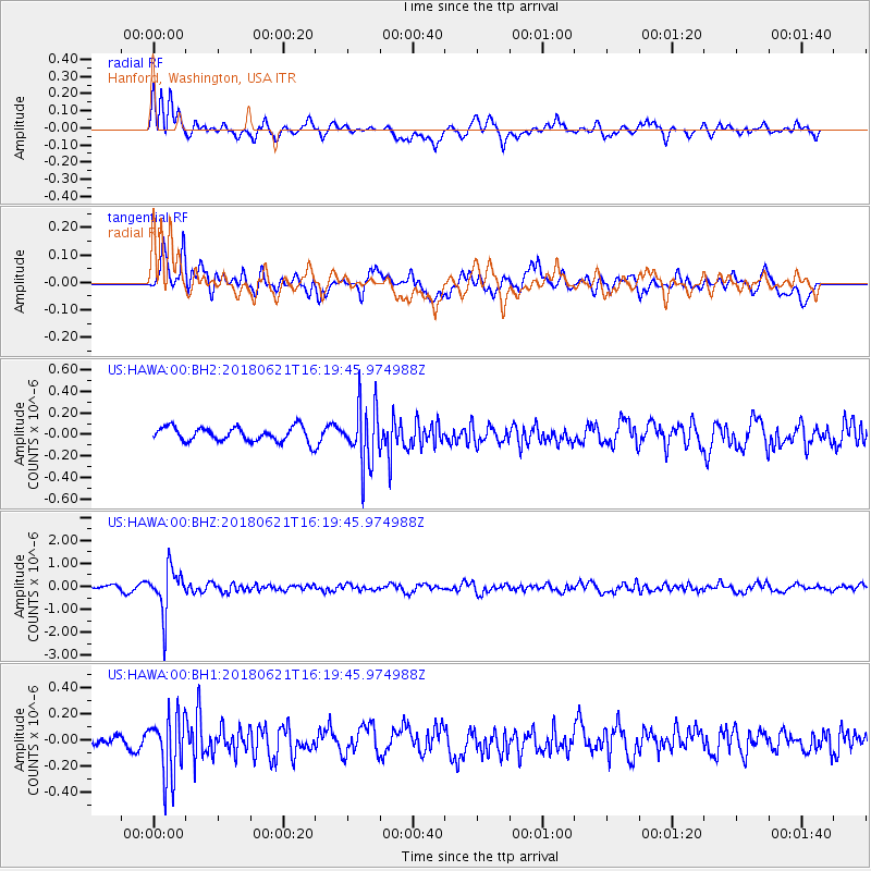
HAWA Hanford, Washington, USA - Earthquake Result Viewer
*The percent match for this event was below the threshold and hence no stack was calculated.
| Earthquake location: |
Chile-Argentina Border Region |
| Earthquake latitude/longitude: |
-24.3/-67.1 |
| Earthquake time(UTC): |
2018/06/21 (172) 16:08:02 GMT |
| Earthquake Depth: |
175 km |
| Earthquake Magnitude: |
5.7 Mww |
| Earthquake Catalog/Contributor: |
NEIC PDE/us |
|
| Network: |
US United States National Seismic Network |
| Station: |
HAWA Hanford, Washington, USA |
| Lat/Lon: |
46.39 N/119.53 W |
| Elevation: |
364 m |
|
| Distance: |
84.9 deg |
| Az: |
326.56 deg |
| Baz: |
133.417 deg |
| Ray Param: |
$rayparam |
*The percent match for this event was below the threshold and hence was not used in the summary stack. |
|
| Radial Match: |
70.2964 % |
| Radial Bump: |
400 |
| Transverse Match: |
66.80638 % |
| Transverse Bump: |
400 |
| SOD ConfigId: |
2709371 |
| Insert Time: |
2018-07-05 16:18:11.373 +0000 |
| GWidth: |
2.5 |
| Max Bumps: |
400 |
| Tol: |
0.001 |
|
Signal To Noise
| Channel | StoN | STA | LTA |
| US:HAWA:00:BHZ:20180621T16:19:45.974988Z | 15.079016 | 9.714132E-7 | 6.442153E-8 |
| US:HAWA:00:BH1:20180621T16:19:45.974988Z | 4.095742 | 2.3108663E-7 | 5.6421186E-8 |
| US:HAWA:00:BH2:20180621T16:19:45.974988Z | 4.038262 | 2.7124284E-7 | 6.7168216E-8 |
| Arrivals |
| Ps | |
| PpPs | |
| PsPs/PpSs | |


