You are here: Home > Network List > UU - University of Utah Regional Network Stations List
> Station FORU South Mineral Mountains, UT, USA > Earthquake Result Viewer
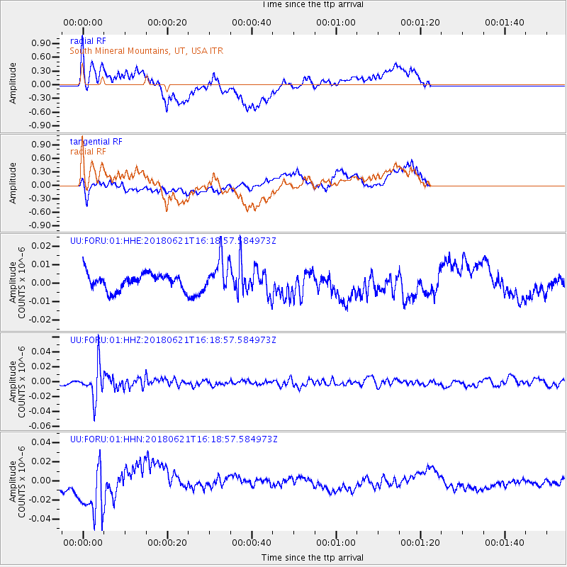
FORU South Mineral Mountains, UT, USA - Earthquake Result Viewer
*The percent match for this event was below the threshold and hence no stack was calculated.
| Earthquake location: |
Chile-Argentina Border Region |
| Earthquake latitude/longitude: |
-24.3/-67.1 |
| Earthquake time(UTC): |
2018/06/21 (172) 16:08:02 GMT |
| Earthquake Depth: |
175 km |
| Earthquake Magnitude: |
5.7 Mww |
| Earthquake Catalog/Contributor: |
NEIC PDE/us |
|
| Network: |
UU University of Utah Regional Network |
| Station: |
FORU South Mineral Mountains, UT, USA |
| Lat/Lon: |
38.46 N/112.86 W |
| Elevation: |
1840 m |
|
| Distance: |
75.8 deg |
| Az: |
324.507 deg |
| Baz: |
137.569 deg |
| Ray Param: |
$rayparam |
*The percent match for this event was below the threshold and hence was not used in the summary stack. |
|
| Radial Match: |
61.605095 % |
| Radial Bump: |
400 |
| Transverse Match: |
65.210045 % |
| Transverse Bump: |
400 |
| SOD ConfigId: |
2709371 |
| Insert Time: |
2018-07-05 16:19:27.312 +0000 |
| GWidth: |
2.5 |
| Max Bumps: |
400 |
| Tol: |
0.001 |
|
Signal To Noise
| Channel | StoN | STA | LTA |
| UU:FORU:01:HHZ:20180621T16:18:57.584973Z | 8.496504 | 2.2612523E-8 | 2.6613916E-9 |
| UU:FORU:01:HHN:20180621T16:18:57.584973Z | 4.299062 | 2.7233247E-8 | 6.334695E-9 |
| UU:FORU:01:HHE:20180621T16:18:57.584973Z | 2.0965214 | 9.150685E-9 | 4.3646993E-9 |
| Arrivals |
| Ps | |
| PpPs | |
| PsPs/PpSs | |


