You are here: Home > Network List > IW - Intermountain West Stations List
> Station MOOW Moose Ponds, Wyoming, USA > Earthquake Result Viewer
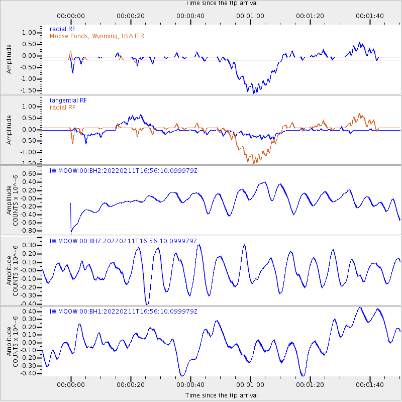
MOOW Moose Ponds, Wyoming, USA - Earthquake Result Viewer
*The percent match for this event was below the threshold and hence no stack was calculated.
| Earthquake location: |
Taiwan Region |
| Earthquake latitude/longitude: |
24.0/122.3 |
| Earthquake time(UTC): |
2022/02/11 (042) 16:43:10 GMT |
| Earthquake Depth: |
10 km |
| Earthquake Magnitude: |
5.5 Mww |
| Earthquake Catalog/Contributor: |
NEIC PDE/us |
|
| Network: |
IW Intermountain West |
| Station: |
MOOW Moose Ponds, Wyoming, USA |
| Lat/Lon: |
43.75 N/110.74 W |
| Elevation: |
2128 m |
|
| Distance: |
96.9 deg |
| Az: |
35.695 deg |
| Baz: |
312.577 deg |
| Ray Param: |
$rayparam |
*The percent match for this event was below the threshold and hence was not used in the summary stack. |
|
| Radial Match: |
35.075745 % |
| Radial Bump: |
400 |
| Transverse Match: |
25.192007 % |
| Transverse Bump: |
400 |
| SOD ConfigId: |
26694651 |
| Insert Time: |
2022-02-25 16:53:20.145 +0000 |
| GWidth: |
2.5 |
| Max Bumps: |
400 |
| Tol: |
0.001 |
|
Signal To Noise
| Channel | StoN | STA | LTA |
| IW:MOOW:00:BHZ:20220211T16:56:10.099979Z | 0.534051 | 6.422074E-8 | 1.2025207E-7 |
| IW:MOOW:00:BH1:20220211T16:56:10.099979Z | 0.5882569 | 2.6754222E-7 | 4.5480502E-7 |
| IW:MOOW:00:BH2:20220211T16:56:10.099979Z | 1.4651372 | 2.8469935E-7 | 1.9431583E-7 |
| Arrivals |
| Ps | |
| PpPs | |
| PsPs/PpSs | |


