You are here: Home > Network List > US - United States National Seismic Network Stations List
> Station LKWY Lake (Yellowstone--Lake), Wyoming, USA > Earthquake Result Viewer
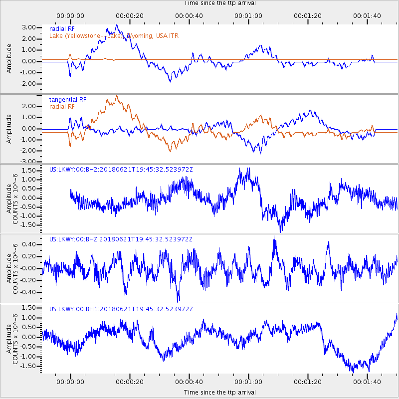
LKWY Lake (Yellowstone--Lake), Wyoming, USA - Earthquake Result Viewer
*The percent match for this event was below the threshold and hence no stack was calculated.
| Earthquake location: |
Tonga Islands Region |
| Earthquake latitude/longitude: |
-22.5/-174.9 |
| Earthquake time(UTC): |
2018/06/21 (172) 19:33:08 GMT |
| Earthquake Depth: |
4.8 km |
| Earthquake Magnitude: |
5.4 mb |
| Earthquake Catalog/Contributor: |
NEIC PDE/us |
|
| Network: |
US United States National Seismic Network |
| Station: |
LKWY Lake (Yellowstone--Lake), Wyoming, USA |
| Lat/Lon: |
44.57 N/110.40 W |
| Elevation: |
2424 m |
|
| Distance: |
89.0 deg |
| Az: |
40.191 deg |
| Baz: |
236.581 deg |
| Ray Param: |
$rayparam |
*The percent match for this event was below the threshold and hence was not used in the summary stack. |
|
| Radial Match: |
33.36084 % |
| Radial Bump: |
400 |
| Transverse Match: |
30.597147 % |
| Transverse Bump: |
400 |
| SOD ConfigId: |
2709371 |
| Insert Time: |
2018-07-05 19:38:21.195 +0000 |
| GWidth: |
2.5 |
| Max Bumps: |
400 |
| Tol: |
0.001 |
|
Signal To Noise
| Channel | StoN | STA | LTA |
| US:LKWY:00:BHZ:20180621T19:45:32.523972Z | 1.0945385 | 1.0623846E-7 | 9.706234E-8 |
| US:LKWY:00:BH1:20180621T19:45:32.523972Z | 1.7884701 | 4.851586E-7 | 2.7127015E-7 |
| US:LKWY:00:BH2:20180621T19:45:32.523972Z | 1.6784103 | 4.7070674E-7 | 2.8044795E-7 |
| Arrivals |
| Ps | |
| PpPs | |
| PsPs/PpSs | |


