You are here: Home > Network List > AV - Alaska Volcano Observatory Stations List
> Station SPCR Ckakachatna River, Mount Spurr, Alaska > Earthquake Result Viewer
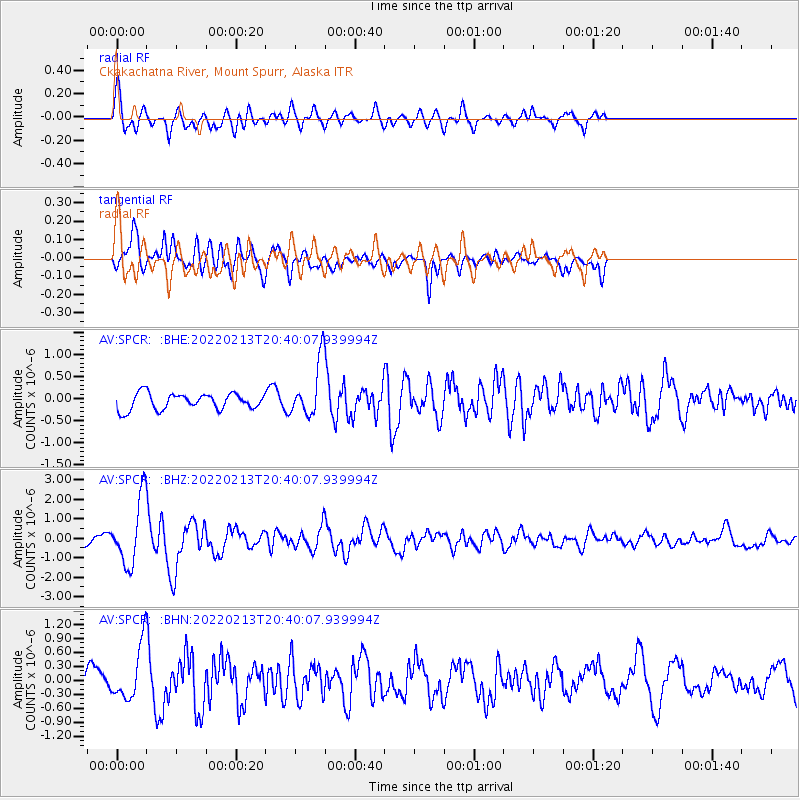
SPCR Ckakachatna River, Mount Spurr, Alaska - Earthquake Result Viewer
*The percent match for this event was below the threshold and hence no stack was calculated.
| Earthquake location: |
South Of Mariana Islands |
| Earthquake latitude/longitude: |
11.8/144.3 |
| Earthquake time(UTC): |
2022/02/13 (044) 20:29:45 GMT |
| Earthquake Depth: |
10 km |
| Earthquake Magnitude: |
5.7 Mww |
| Earthquake Catalog/Contributor: |
NEIC PDE/us |
|
| Network: |
AV Alaska Volcano Observatory |
| Station: |
SPCR Ckakachatna River, Mount Spurr, Alaska |
| Lat/Lon: |
61.20 N/152.21 W |
| Elevation: |
984 m |
|
| Distance: |
67.1 deg |
| Az: |
28.062 deg |
| Baz: |
252.035 deg |
| Ray Param: |
$rayparam |
*The percent match for this event was below the threshold and hence was not used in the summary stack. |
|
| Radial Match: |
74.51679 % |
| Radial Bump: |
400 |
| Transverse Match: |
67.76067 % |
| Transverse Bump: |
400 |
| SOD ConfigId: |
26694651 |
| Insert Time: |
2022-02-27 20:37:59.715 +0000 |
| GWidth: |
2.5 |
| Max Bumps: |
400 |
| Tol: |
0.001 |
|
Signal To Noise
| Channel | StoN | STA | LTA |
| AV:SPCR: :BHZ:20220213T20:40:07.939994Z | 7.2923203 | 1.672894E-6 | 2.294049E-7 |
| AV:SPCR: :BHN:20220213T20:40:07.939994Z | 2.8049803 | 5.75993E-7 | 2.0534654E-7 |
| AV:SPCR: :BHE:20220213T20:40:07.939994Z | 3.3668067 | 6.1282753E-7 | 1.8202041E-7 |
| Arrivals |
| Ps | |
| PpPs | |
| PsPs/PpSs | |


