You are here: Home > Network List > C8 - Canadian Seismic Research Network () Stations List
> Station GRIB Gribbell Island, BC, CA > Earthquake Result Viewer
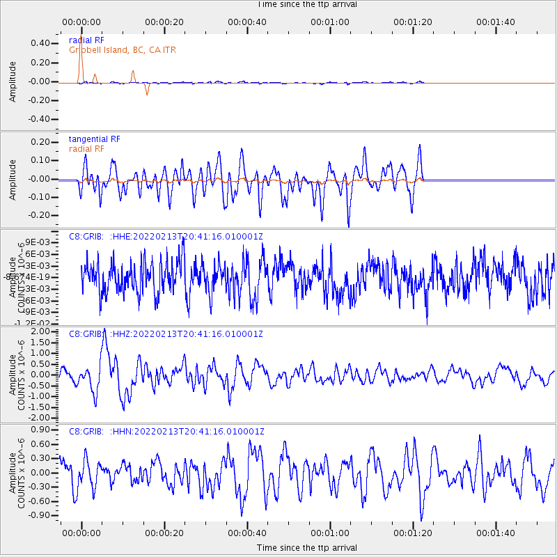
GRIB Gribbell Island, BC, CA - Earthquake Result Viewer
*The percent match for this event was below the threshold and hence no stack was calculated.
| Earthquake location: |
South Of Mariana Islands |
| Earthquake latitude/longitude: |
11.8/144.3 |
| Earthquake time(UTC): |
2022/02/13 (044) 20:29:45 GMT |
| Earthquake Depth: |
10 km |
| Earthquake Magnitude: |
5.7 Mww |
| Earthquake Catalog/Contributor: |
NEIC PDE/us |
|
| Network: |
C8 Canadian Seismic Research Network () |
| Station: |
GRIB Gribbell Island, BC, CA |
| Lat/Lon: |
53.34 N/129.14 W |
| Elevation: |
418 m |
|
| Distance: |
78.6 deg |
| Az: |
37.635 deg |
| Baz: |
274.371 deg |
| Ray Param: |
$rayparam |
*The percent match for this event was below the threshold and hence was not used in the summary stack. |
|
| Radial Match: |
66.47536 % |
| Radial Bump: |
400 |
| Transverse Match: |
66.07014 % |
| Transverse Bump: |
400 |
| SOD ConfigId: |
26694651 |
| Insert Time: |
2022-02-27 20:39:27.361 +0000 |
| GWidth: |
2.5 |
| Max Bumps: |
400 |
| Tol: |
0.001 |
|
Signal To Noise
| Channel | StoN | STA | LTA |
| C8:GRIB: :HHZ:20220213T20:41:16.010001Z | 3.4609919 | 6.1841536E-7 | 1.7868153E-7 |
| C8:GRIB: :HHN:20220213T20:41:16.010001Z | 1.1437087 | 2.7889755E-7 | 2.4385363E-7 |
| C8:GRIB: :HHE:20220213T20:41:16.010001Z | 0.93967634 | 3.5875614E-9 | 3.817869E-9 |
| Arrivals |
| Ps | |
| PpPs | |
| PsPs/PpSs | |


