You are here: Home > Network List > CI - Caltech Regional Seismic Network Stations List
> Station SMM Simmler, CA, USA > Earthquake Result Viewer
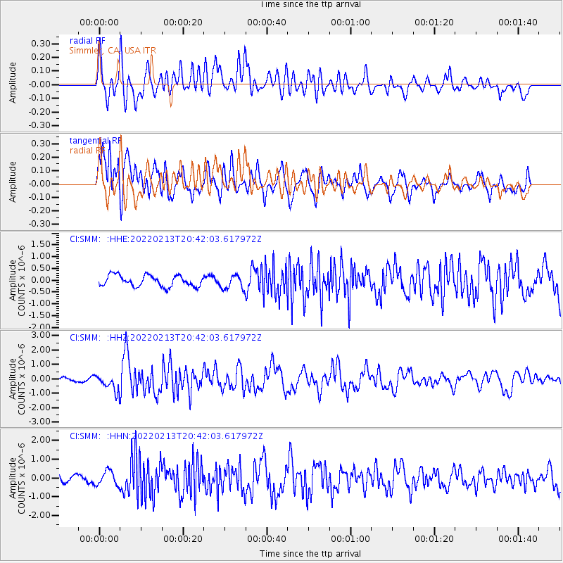
SMM Simmler, CA, USA - Earthquake Result Viewer
*The percent match for this event was below the threshold and hence no stack was calculated.
| Earthquake location: |
South Of Mariana Islands |
| Earthquake latitude/longitude: |
11.8/144.3 |
| Earthquake time(UTC): |
2022/02/13 (044) 20:29:45 GMT |
| Earthquake Depth: |
10 km |
| Earthquake Magnitude: |
5.7 Mww |
| Earthquake Catalog/Contributor: |
NEIC PDE/us |
|
| Network: |
CI Caltech Regional Seismic Network |
| Station: |
SMM Simmler, CA, USA |
| Lat/Lon: |
35.31 N/120.00 W |
| Elevation: |
599 m |
|
| Distance: |
87.9 deg |
| Az: |
54.522 deg |
| Baz: |
282.836 deg |
| Ray Param: |
$rayparam |
*The percent match for this event was below the threshold and hence was not used in the summary stack. |
|
| Radial Match: |
68.76059 % |
| Radial Bump: |
400 |
| Transverse Match: |
50.667618 % |
| Transverse Bump: |
400 |
| SOD ConfigId: |
26694651 |
| Insert Time: |
2022-02-27 20:42:17.940 +0000 |
| GWidth: |
2.5 |
| Max Bumps: |
400 |
| Tol: |
0.001 |
|
Signal To Noise
| Channel | StoN | STA | LTA |
| CI:SMM: :HHZ:20220213T20:42:03.617972Z | 2.5563753 | 5.646099E-7 | 2.2086347E-7 |
| CI:SMM: :HHN:20220213T20:42:03.617972Z | 0.7026518 | 3.8161235E-7 | 5.431031E-7 |
| CI:SMM: :HHE:20220213T20:42:03.617972Z | 1.2561423 | 2.957517E-7 | 2.3544445E-7 |
| Arrivals |
| Ps | |
| PpPs | |
| PsPs/PpSs | |


