You are here: Home > Network List > IW - Intermountain West Stations List
> Station MOOW Moose Ponds, Wyoming, USA > Earthquake Result Viewer
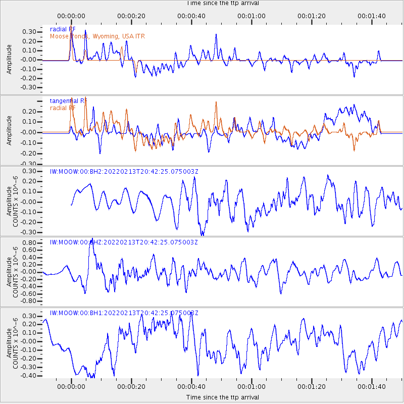
MOOW Moose Ponds, Wyoming, USA - Earthquake Result Viewer
*The percent match for this event was below the threshold and hence no stack was calculated.
| Earthquake location: |
South Of Mariana Islands |
| Earthquake latitude/longitude: |
11.8/144.3 |
| Earthquake time(UTC): |
2022/02/13 (044) 20:29:45 GMT |
| Earthquake Depth: |
10 km |
| Earthquake Magnitude: |
5.7 Mww |
| Earthquake Catalog/Contributor: |
NEIC PDE/us |
|
| Network: |
IW Intermountain West |
| Station: |
MOOW Moose Ponds, Wyoming, USA |
| Lat/Lon: |
43.75 N/110.74 W |
| Elevation: |
2128 m |
|
| Distance: |
92.5 deg |
| Az: |
44.492 deg |
| Baz: |
288.754 deg |
| Ray Param: |
$rayparam |
*The percent match for this event was below the threshold and hence was not used in the summary stack. |
|
| Radial Match: |
50.06822 % |
| Radial Bump: |
400 |
| Transverse Match: |
25.016207 % |
| Transverse Bump: |
400 |
| SOD ConfigId: |
26694651 |
| Insert Time: |
2022-02-27 20:46:39.356 +0000 |
| GWidth: |
2.5 |
| Max Bumps: |
400 |
| Tol: |
0.001 |
|
Signal To Noise
| Channel | StoN | STA | LTA |
| IW:MOOW:00:BHZ:20220213T20:42:25.075003Z | 4.8249826 | 2.5950476E-7 | 5.3783562E-8 |
| IW:MOOW:00:BH1:20220213T20:42:25.075003Z | 4.892314 | 4.3517284E-7 | 8.895031E-8 |
| IW:MOOW:00:BH2:20220213T20:42:25.075003Z | 1.5900377 | 1.192739E-7 | 7.501326E-8 |
| Arrivals |
| Ps | |
| PpPs | |
| PsPs/PpSs | |


