You are here: Home > Network List > US - United States National Seismic Network Stations List
> Station MSO Missoula, Montana, USA > Earthquake Result Viewer
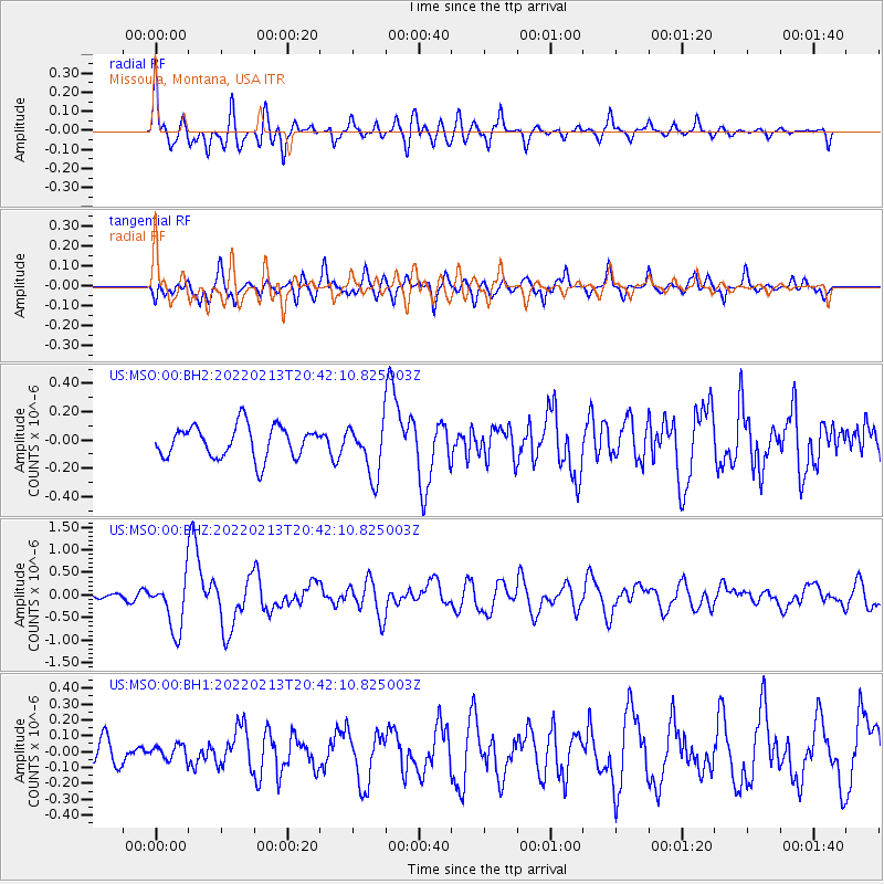
MSO Missoula, Montana, USA - Earthquake Result Viewer
*The percent match for this event was below the threshold and hence no stack was calculated.
| Earthquake location: |
South Of Mariana Islands |
| Earthquake latitude/longitude: |
11.8/144.3 |
| Earthquake time(UTC): |
2022/02/13 (044) 20:29:45 GMT |
| Earthquake Depth: |
10 km |
| Earthquake Magnitude: |
5.7 Mww |
| Earthquake Catalog/Contributor: |
NEIC PDE/us |
|
| Network: |
US United States National Seismic Network |
| Station: |
MSO Missoula, Montana, USA |
| Lat/Lon: |
46.83 N/113.94 W |
| Elevation: |
1264 m |
|
| Distance: |
89.4 deg |
| Az: |
42.241 deg |
| Baz: |
286.526 deg |
| Ray Param: |
$rayparam |
*The percent match for this event was below the threshold and hence was not used in the summary stack. |
|
| Radial Match: |
75.59541 % |
| Radial Bump: |
400 |
| Transverse Match: |
71.18073 % |
| Transverse Bump: |
400 |
| SOD ConfigId: |
26694651 |
| Insert Time: |
2022-02-27 20:52:37.125 +0000 |
| GWidth: |
2.5 |
| Max Bumps: |
400 |
| Tol: |
0.001 |
|
Signal To Noise
| Channel | StoN | STA | LTA |
| US:MSO:00:BHZ:20220213T20:42:10.825003Z | 5.7109103 | 5.781064E-7 | 1.01228416E-7 |
| US:MSO:00:BH1:20220213T20:42:10.825003Z | 0.40797618 | 4.565126E-8 | 1.11896874E-7 |
| US:MSO:00:BH2:20220213T20:42:10.825003Z | 1.6451484 | 1.865094E-7 | 1.13369346E-7 |
| Arrivals |
| Ps | |
| PpPs | |
| PsPs/PpSs | |


