You are here: Home > Network List > UW - Pacific Northwest Regional Seismic Network Stations List
> Station LEBA Lebam, WA, USA > Earthquake Result Viewer
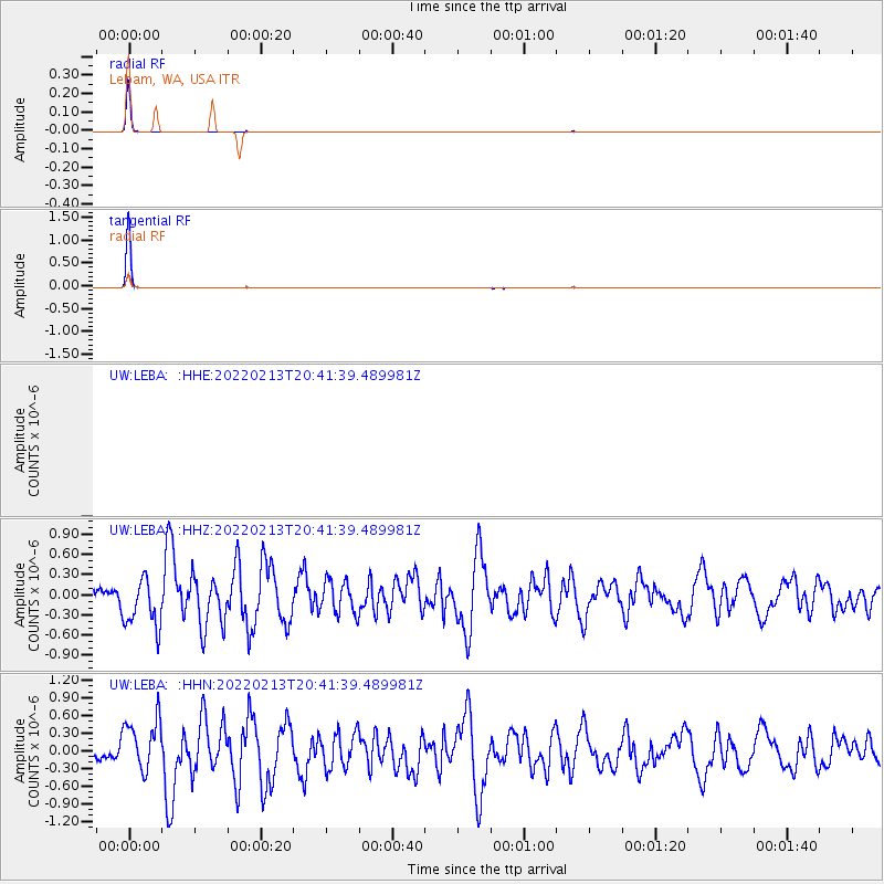
LEBA Lebam, WA, USA - Earthquake Result Viewer
*The percent match for this event was below the threshold and hence no stack was calculated.
| Earthquake location: |
South Of Mariana Islands |
| Earthquake latitude/longitude: |
11.8/144.3 |
| Earthquake time(UTC): |
2022/02/13 (044) 20:29:45 GMT |
| Earthquake Depth: |
10 km |
| Earthquake Magnitude: |
5.7 Mww |
| Earthquake Catalog/Contributor: |
NEIC PDE/us |
|
| Network: |
UW Pacific Northwest Regional Seismic Network |
| Station: |
LEBA Lebam, WA, USA |
| Lat/Lon: |
46.55 N/123.56 W |
| Elevation: |
73 m |
|
| Distance: |
83.0 deg |
| Az: |
44.018 deg |
| Baz: |
279.657 deg |
| Ray Param: |
$rayparam |
*The percent match for this event was below the threshold and hence was not used in the summary stack. |
|
| Radial Match: |
99.79975 % |
| Radial Bump: |
24 |
| Transverse Match: |
99.79975 % |
| Transverse Bump: |
24 |
| SOD ConfigId: |
26694651 |
| Insert Time: |
2022-02-27 20:53:53.447 +0000 |
| GWidth: |
2.5 |
| Max Bumps: |
400 |
| Tol: |
0.001 |
|
Signal To Noise
| Channel | StoN | STA | LTA |
| UW:LEBA: :HHZ:20220213T20:41:39.489981Z | 3.0885777 | 3.771436E-7 | 1.2210916E-7 |
| UW:LEBA: :HHN:20220213T20:41:39.489981Z | 3.0319092 | 4.45534E-7 | 1.4694832E-7 |
| $trig.getChannelId() | $trig.getValue() | $trig.getSTA() | $trig.getLTA() |
| Arrivals |
| Ps | |
| PpPs | |
| PsPs/PpSs | |


