You are here: Home > Network List > UW - Pacific Northwest Regional Seismic Network Stations List
> Station LON Longmire CREST broad-band > Earthquake Result Viewer
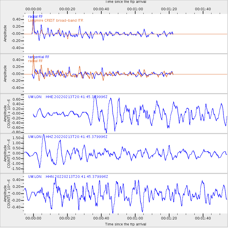
LON Longmire CREST broad-band - Earthquake Result Viewer
*The percent match for this event was below the threshold and hence no stack was calculated.
| Earthquake location: |
South Of Mariana Islands |
| Earthquake latitude/longitude: |
11.8/144.3 |
| Earthquake time(UTC): |
2022/02/13 (044) 20:29:45 GMT |
| Earthquake Depth: |
10 km |
| Earthquake Magnitude: |
5.7 Mww |
| Earthquake Catalog/Contributor: |
NEIC PDE/us |
|
| Network: |
UW Pacific Northwest Regional Seismic Network |
| Station: |
LON Longmire CREST broad-band |
| Lat/Lon: |
46.75 N/121.81 W |
| Elevation: |
853 m |
|
| Distance: |
84.2 deg |
| Az: |
43.599 deg |
| Baz: |
280.881 deg |
| Ray Param: |
$rayparam |
*The percent match for this event was below the threshold and hence was not used in the summary stack. |
|
| Radial Match: |
79.27129 % |
| Radial Bump: |
400 |
| Transverse Match: |
76.20484 % |
| Transverse Bump: |
400 |
| SOD ConfigId: |
26694651 |
| Insert Time: |
2022-02-27 20:53:59.721 +0000 |
| GWidth: |
2.5 |
| Max Bumps: |
400 |
| Tol: |
0.001 |
|
Signal To Noise
| Channel | StoN | STA | LTA |
| UW:LON: :HHZ:20220213T20:41:45.379996Z | 4.9913764 | 5.504285E-7 | 1.10275906E-7 |
| UW:LON: :HHN:20220213T20:41:45.379996Z | 0.6311282 | 6.333316E-8 | 1.0034912E-7 |
| UW:LON: :HHE:20220213T20:41:45.379996Z | 2.6154327 | 2.2388998E-7 | 8.560342E-8 |
| Arrivals |
| Ps | |
| PpPs | |
| PsPs/PpSs | |


