You are here: Home > Network List > CN - Canadian National Seismograph Network Stations List
> Station INK INUVIK, NT > Earthquake Result Viewer
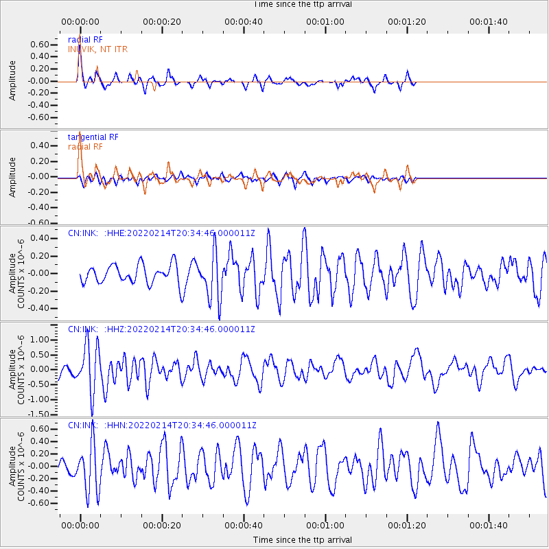
INK INUVIK, NT - Earthquake Result Viewer
*The percent match for this event was below the threshold and hence no stack was calculated.
| Earthquake location: |
Jan Mayen Island Region |
| Earthquake latitude/longitude: |
70.7/-14.4 |
| Earthquake time(UTC): |
2022/02/14 (045) 20:28:21 GMT |
| Earthquake Depth: |
10 km |
| Earthquake Magnitude: |
5.7 Mww |
| Earthquake Catalog/Contributor: |
NEIC PDE/us |
|
| Network: |
CN Canadian National Seismograph Network |
| Station: |
INK INUVIK, NT |
| Lat/Lon: |
68.31 N/133.53 W |
| Elevation: |
44 m |
|
| Distance: |
35.4 deg |
| Az: |
325.875 deg |
| Baz: |
30.06 deg |
| Ray Param: |
$rayparam |
*The percent match for this event was below the threshold and hence was not used in the summary stack. |
|
| Radial Match: |
73.276146 % |
| Radial Bump: |
254 |
| Transverse Match: |
48.0234 % |
| Transverse Bump: |
345 |
| SOD ConfigId: |
26694651 |
| Insert Time: |
2022-02-28 20:39:38.874 +0000 |
| GWidth: |
2.5 |
| Max Bumps: |
400 |
| Tol: |
0.001 |
|
Signal To Noise
| Channel | StoN | STA | LTA |
| CN:INK: :HHZ:20220214T20:34:46.000011Z | 4.258023 | 8.1743815E-7 | 1.9197599E-7 |
| CN:INK: :HHN:20220214T20:34:46.000011Z | 3.0529506 | 4.0109435E-7 | 1.3137925E-7 |
| CN:INK: :HHE:20220214T20:34:46.000011Z | 2.6398978 | 2.7210953E-7 | 1.03075784E-7 |
| Arrivals |
| Ps | |
| PpPs | |
| PsPs/PpSs | |


