You are here: Home > Network List > GS - US Geological Survey Networks Stations List
> Station OK051 E0350 and S34600 roads, Ralston OK > Earthquake Result Viewer
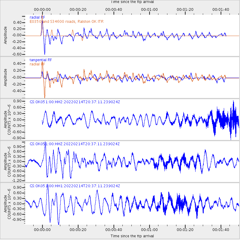
OK051 E0350 and S34600 roads, Ralston OK - Earthquake Result Viewer
*The percent match for this event was below the threshold and hence no stack was calculated.
| Earthquake location: |
Jan Mayen Island Region |
| Earthquake latitude/longitude: |
70.7/-14.4 |
| Earthquake time(UTC): |
2022/02/14 (045) 20:28:21 GMT |
| Earthquake Depth: |
10 km |
| Earthquake Magnitude: |
5.7 Mww |
| Earthquake Catalog/Contributor: |
NEIC PDE/us |
|
| Network: |
GS US Geological Survey Networks |
| Station: |
OK051 E0350 and S34600 roads, Ralston OK |
| Lat/Lon: |
36.50 N/96.84 W |
| Elevation: |
263 m |
|
| Distance: |
53.6 deg |
| Az: |
276.929 deg |
| Baz: |
24.142 deg |
| Ray Param: |
$rayparam |
*The percent match for this event was below the threshold and hence was not used in the summary stack. |
|
| Radial Match: |
65.56772 % |
| Radial Bump: |
396 |
| Transverse Match: |
48.06634 % |
| Transverse Bump: |
400 |
| SOD ConfigId: |
26694651 |
| Insert Time: |
2022-02-28 20:42:32.910 +0000 |
| GWidth: |
2.5 |
| Max Bumps: |
400 |
| Tol: |
0.001 |
|
Signal To Noise
| Channel | StoN | STA | LTA |
| GS:OK051:00:HHZ:20220214T20:37:11.239024Z | 3.2018013 | 5.553259E-7 | 1.7344172E-7 |
| GS:OK051:00:HH1:20220214T20:37:11.239024Z | 3.189186 | 6.008061E-7 | 1.8838854E-7 |
| GS:OK051:00:HH2:20220214T20:37:11.239024Z | 0.68215156 | 1.2851372E-7 | 1.883947E-7 |
| Arrivals |
| Ps | |
| PpPs | |
| PsPs/PpSs | |


