AQU L'Aquila, Italy - Earthquake Result Viewer
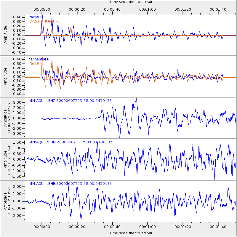
Earthquake location: Southern Sumatra, Indonesia
Earthquake latitude/longitude: -4.6/101.9
Earthquake time(UTC): 2000/06/07 (159) 23:45:26 GMT
Earthquake Depth: 33 km
Earthquake Magnitude: 6.1 MB, 6.7 MS, 6.7 MW, 6.5 MW
Earthquake Catalog/Contributor: WHDF/NEIC
Network: MN MEDNET Project
Station: AQU L'Aquila, Italy
Lat/Lon: 42.35 N/13.40 E
Elevation: 710 m
Distance: 92.0 deg
Az: 312.147 deg
Baz: 94.403 deg
Ray Param: 0.041521605
Estimated Moho Depth: 31.75 km
Estimated Crust Vp/Vs: 2.10
Assumed Crust Vp: 6.276 km/s
Estimated Crust Vs: 2.992 km/s
Estimated Crust Poisson's Ratio: 0.35
Radial Match: 90.0974 %
Radial Bump: 400
Transverse Match: 88.73943 %
Transverse Bump: 400
SOD ConfigId: 3744
Insert Time: 2010-02-26 16:22:20.948 +0000
GWidth: 2.5
Max Bumps: 400
Tol: 0.001

Signal To Noise

ChannelStoNSTALTA
MN:AQU: :BHN:20000607T23:58:00.643013Z0.986050841.2099302E-71.2270465E-7
MN:AQU: :BHE:20000607T23:58:00.643013Z1.70339542.4943816E-71.4643585E-7
MN:AQU: :BHZ:20000607T23:58:00.643013Z7.3995246.9131835E-79.34274E-8
Arrivals
Ps5.6 SECOND
PpPs15 SECOND
PsPs/PpSs21 SECOND