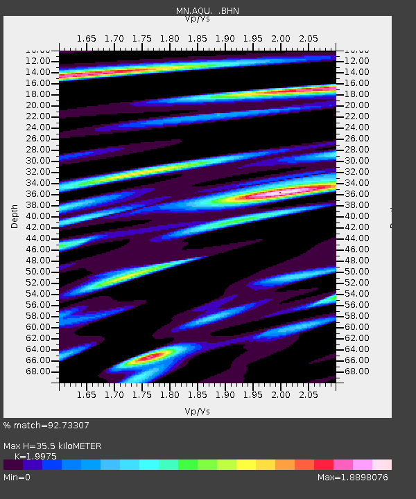
AQU L'Aquila, Italy - Earthquake Result Viewer
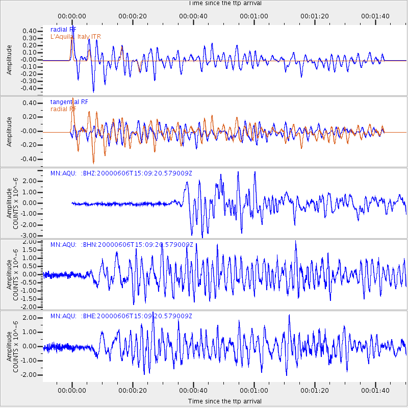
Earthquake location: Southeast Of Ryukyu Islands
Earthquake latitude/longitude: 29.4/131.4
Earthquake time(UTC): 2000/06/06 (158) 14:57:02 GMT
Earthquake Depth: 33 km
Earthquake Magnitude: 5.8 MB, 6.0 MS, 6.4 MW, 6.4 MW
Earthquake Catalog/Contributor: WHDF/NEIC
Network: MN MEDNET Project
Station: AQU L'Aquila, Italy
Lat/Lon: 42.35 N/13.40 E
Elevation: 710 m
Distance: 88.6 deg
Az: 319.112 deg
Baz: 50.391 deg
Ray Param: 0.04241897
Estimated Moho Depth: 35.5 km
Estimated Crust Vp/Vs: 2.00
Assumed Crust Vp: 6.276 km/s
Estimated Crust Vs: 3.142 km/s
Estimated Crust Poisson's Ratio: 0.33
Radial Match: 92.73307 %
Radial Bump: 400
Transverse Match: 87.38103 %
Transverse Bump: 400
SOD ConfigId: 3744
Insert Time: 2010-02-26 16:22:28.297 +0000
GWidth: 2.5
Max Bumps: 400
Tol: 0.001

Signal To Noise

ChannelStoNSTALTA
MN:AQU: :BHN:20000606T15:09:20.579009Z0.78726669.714733E-81.2339825E-7
MN:AQU: :BHE:20000606T15:09:20.579009Z0.7193989.532547E-81.3250727E-7
MN:AQU: :BHZ:20000606T15:09:20.579009Z2.08254621.3230097E-76.352847E-8
Arrivals
Ps5.7 SECOND
PpPs17 SECOND
PsPs/PpSs22 SECOND