You are here: Home > Network List > CI - Caltech Regional Seismic Network Stations List
> Station MPP McPhearson Peak > Earthquake Result Viewer
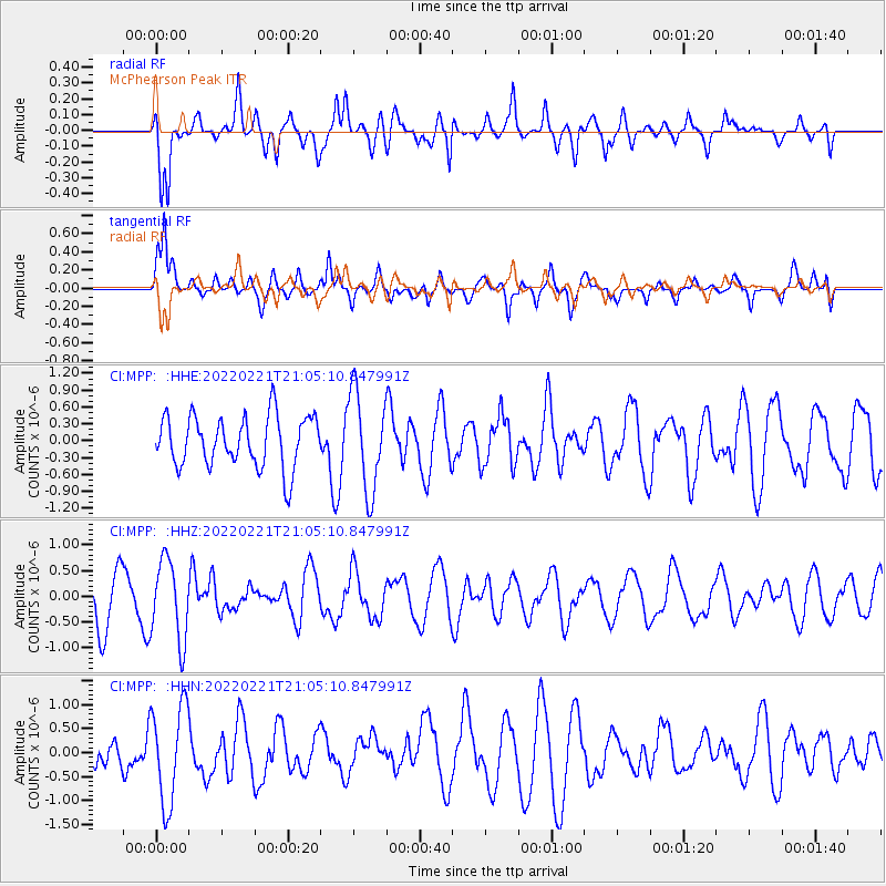
MPP McPhearson Peak - Earthquake Result Viewer
*The percent match for this event was below the threshold and hence no stack was calculated.
| Earthquake location: |
Ryukyu Islands, Japan |
| Earthquake latitude/longitude: |
26.8/126.5 |
| Earthquake time(UTC): |
2022/02/21 (052) 20:52:32 GMT |
| Earthquake Depth: |
14 km |
| Earthquake Magnitude: |
5.6 mb |
| Earthquake Catalog/Contributor: |
NEIC PDE/us |
|
| Network: |
CI Caltech Regional Seismic Network |
| Station: |
MPP McPhearson Peak |
| Lat/Lon: |
34.89 N/119.81 W |
| Elevation: |
1739 m |
|
| Distance: |
92.3 deg |
| Az: |
48.879 deg |
| Baz: |
305.024 deg |
| Ray Param: |
$rayparam |
*The percent match for this event was below the threshold and hence was not used in the summary stack. |
|
| Radial Match: |
61.357407 % |
| Radial Bump: |
400 |
| Transverse Match: |
60.28807 % |
| Transverse Bump: |
400 |
| SOD ConfigId: |
26694651 |
| Insert Time: |
2022-03-07 21:02:10.826 +0000 |
| GWidth: |
2.5 |
| Max Bumps: |
400 |
| Tol: |
0.001 |
|
Signal To Noise
| Channel | StoN | STA | LTA |
| CI:MPP: :HHZ:20220221T21:05:10.847991Z | 1.9858042 | 7.7952876E-7 | 3.9255065E-7 |
| CI:MPP: :HHN:20220221T21:05:10.847991Z | 3.494775 | 1.0166071E-6 | 2.9089347E-7 |
| CI:MPP: :HHE:20220221T21:05:10.847991Z | 1.9164608 | 8.767226E-7 | 4.574696E-7 |
| Arrivals |
| Ps | |
| PpPs | |
| PsPs/PpSs | |


