You are here: Home > Network List > US - United States National Seismic Network Stations List
> Station WMOK Wichita Mountains, Oklahoma, USA > Earthquake Result Viewer
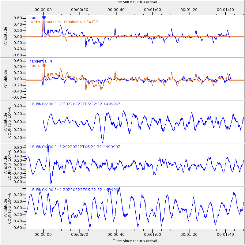
WMOK Wichita Mountains, Oklahoma, USA - Earthquake Result Viewer
*The percent match for this event was below the threshold and hence no stack was calculated.
| Earthquake location: |
Jujuy Province, Argentina |
| Earthquake latitude/longitude: |
-22.7/-66.3 |
| Earthquake time(UTC): |
2022/02/22 (053) 06:12:49 GMT |
| Earthquake Depth: |
242 km |
| Earthquake Magnitude: |
6.0 mww |
| Earthquake Catalog/Contributor: |
NEIC PDE/us |
|
| Network: |
US United States National Seismic Network |
| Station: |
WMOK Wichita Mountains, Oklahoma, USA |
| Lat/Lon: |
34.74 N/98.78 W |
| Elevation: |
486 m |
|
| Distance: |
64.9 deg |
| Az: |
330.737 deg |
| Baz: |
146.752 deg |
| Ray Param: |
$rayparam |
*The percent match for this event was below the threshold and hence was not used in the summary stack. |
|
| Radial Match: |
57.39735 % |
| Radial Bump: |
400 |
| Transverse Match: |
47.15272 % |
| Transverse Bump: |
400 |
| SOD ConfigId: |
26694651 |
| Insert Time: |
2022-03-08 06:36:56.298 +0000 |
| GWidth: |
2.5 |
| Max Bumps: |
400 |
| Tol: |
0.001 |
|
Signal To Noise
| Channel | StoN | STA | LTA |
| US:WMOK:00:BHZ:20220222T06:22:32.449999Z | 2.1564214 | 4.768048E-7 | 2.2110929E-7 |
| US:WMOK:00:BH1:20220222T06:22:32.449999Z | 1.1872925 | 2.4796552E-7 | 2.0884957E-7 |
| US:WMOK:00:BH2:20220222T06:22:32.449999Z | 3.47122 | 2.7118702E-7 | 7.812441E-8 |
| Arrivals |
| Ps | |
| PpPs | |
| PsPs/PpSs | |


