You are here: Home > Network List > TX - Texas Seismological Network Stations List
> Station WTFS Witchita Falls > Earthquake Result Viewer
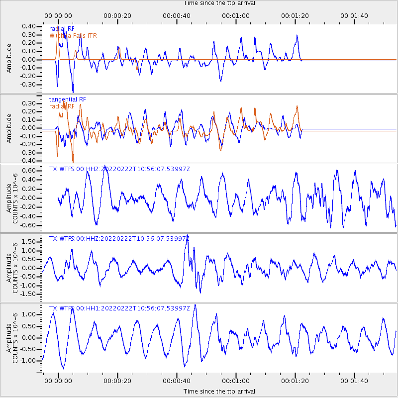
WTFS Witchita Falls - Earthquake Result Viewer
*The percent match for this event was below the threshold and hence no stack was calculated.
| Earthquake location: |
Tonga Islands |
| Earthquake latitude/longitude: |
-16.1/-174.1 |
| Earthquake time(UTC): |
2022/02/22 (053) 10:44:09 GMT |
| Earthquake Depth: |
159 km |
| Earthquake Magnitude: |
5.5 mb |
| Earthquake Catalog/Contributor: |
NEIC PDE/us |
|
| Network: |
TX Texas Seismological Network |
| Station: |
WTFS Witchita Falls |
| Lat/Lon: |
33.77 N/98.46 W |
| Elevation: |
277 m |
|
| Distance: |
87.3 deg |
| Az: |
53.87 deg |
| Baz: |
248.722 deg |
| Ray Param: |
$rayparam |
*The percent match for this event was below the threshold and hence was not used in the summary stack. |
|
| Radial Match: |
57.748768 % |
| Radial Bump: |
400 |
| Transverse Match: |
55.437664 % |
| Transverse Bump: |
400 |
| SOD ConfigId: |
26694651 |
| Insert Time: |
2022-03-08 11:08:43.938 +0000 |
| GWidth: |
2.5 |
| Max Bumps: |
400 |
| Tol: |
0.001 |
|
Signal To Noise
| Channel | StoN | STA | LTA |
| TX:WTFS:00:HHZ:20220222T10:56:07.53997Z | 2.5450552 | 5.4416313E-7 | 2.138119E-7 |
| TX:WTFS:00:HH1:20220222T10:56:07.53997Z | 1.7590978 | 8.202175E-7 | 4.6627167E-7 |
| TX:WTFS:00:HH2:20220222T10:56:07.53997Z | 0.71047324 | 2.0616383E-7 | 2.9017818E-7 |
| Arrivals |
| Ps | |
| PpPs | |
| PsPs/PpSs | |


