AQU L'Aquila, Italy - Earthquake Result Viewer
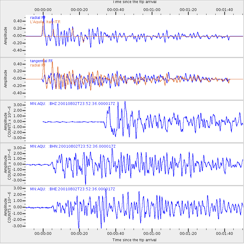
Earthquake location: Near East Coast Of Kamchatka
Earthquake latitude/longitude: 56.3/163.8
Earthquake time(UTC): 2001/08/02 (214) 23:41:06 GMT
Earthquake Depth: 14 km
Earthquake Magnitude: 5.9 MB, 6.2 MS, 6.3 MW, 6.2 ME
Earthquake Catalog/Contributor: WHDF/NEIC
Network: MN MEDNET Project
Station: AQU L'Aquila, Italy
Lat/Lon: 42.35 N/13.40 E
Elevation: 710 m
Distance: 78.6 deg
Az: 338.059 deg
Baz: 16.337 deg
Ray Param: 0.049514845
Estimated Moho Depth: 52.5 km
Estimated Crust Vp/Vs: 1.60
Assumed Crust Vp: 6.276 km/s
Estimated Crust Vs: 3.916 km/s
Estimated Crust Poisson's Ratio: 0.18
Radial Match: 89.131874 %
Radial Bump: 400
Transverse Match: 84.478424 %
Transverse Bump: 400
SOD ConfigId: 3753
Insert Time: 2010-02-26 16:23:06.369 +0000
GWidth: 2.5
Max Bumps: 400
Tol: 0.001

Signal To Noise

ChannelStoNSTALTA
MN:AQU: :BHN:20010802T23:52:36.000017Z2.89515661.2241836E-74.2283844E-8
MN:AQU: :BHE:20010802T23:52:36.000017Z0.881747963.8588702E-84.376387E-8
MN:AQU: :BHZ:20010802T23:52:36.000017Z8.8830433.7162835E-74.18357E-8
Arrivals
Ps5.2 SECOND
PpPs21 SECOND
PsPs/PpSs26 SECOND