You are here: Home > Network List > US - United States National Seismic Network Stations List
> Station AMTX Amarillo, Texas, USA > Earthquake Result Viewer
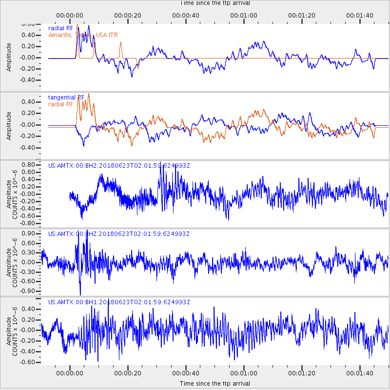
AMTX Amarillo, Texas, USA - Earthquake Result Viewer
*The percent match for this event was below the threshold and hence no stack was calculated.
| Earthquake location: |
Near Coast Of Venezuela |
| Earthquake latitude/longitude: |
10.8/-62.6 |
| Earthquake time(UTC): |
2018/06/23 (174) 01:54:42 GMT |
| Earthquake Depth: |
106 km |
| Earthquake Magnitude: |
5.1 Mww |
| Earthquake Catalog/Contributor: |
NEIC PDE/us |
|
| Network: |
US United States National Seismic Network |
| Station: |
AMTX Amarillo, Texas, USA |
| Lat/Lon: |
34.53 N/101.41 W |
| Elevation: |
1010 m |
|
| Distance: |
42.5 deg |
| Az: |
310.073 deg |
| Baz: |
114.387 deg |
| Ray Param: |
$rayparam |
*The percent match for this event was below the threshold and hence was not used in the summary stack. |
|
| Radial Match: |
61.93166 % |
| Radial Bump: |
400 |
| Transverse Match: |
54.15029 % |
| Transverse Bump: |
400 |
| SOD ConfigId: |
2738091 |
| Insert Time: |
2018-07-07 02:03:09.546 +0000 |
| GWidth: |
2.5 |
| Max Bumps: |
400 |
| Tol: |
0.001 |
|
Signal To Noise
| Channel | StoN | STA | LTA |
| US:AMTX:00:BHZ:20180623T02:01:59.624993Z | 2.719391 | 3.6405305E-7 | 1.3387299E-7 |
| US:AMTX:00:BH1:20180623T02:01:59.624993Z | 2.152306 | 2.0749232E-7 | 9.640465E-8 |
| US:AMTX:00:BH2:20180623T02:01:59.624993Z | 1.0602796 | 2.733762E-7 | 2.5783405E-7 |
| Arrivals |
| Ps | |
| PpPs | |
| PsPs/PpSs | |


