AQU L'Aquila, Italy - Earthquake Result Viewer
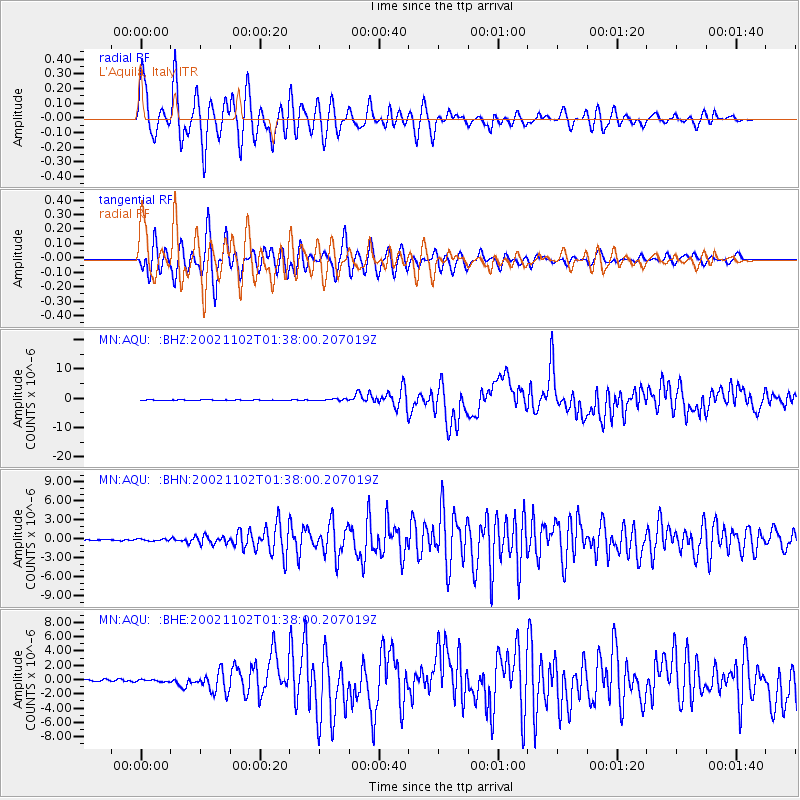
Earthquake location: Northern Sumatra, Indonesia
Earthquake latitude/longitude: 2.8/96.1
Earthquake time(UTC): 2002/11/02 (306) 01:26:10 GMT
Earthquake Depth: 30 km
Earthquake Magnitude: 6.2 MB, 7.6 MS, 7.4 MW, 7.4 MW
Earthquake Catalog/Contributor: WHDF/NEIC
Network: MN MEDNET Project
Station: AQU L'Aquila, Italy
Lat/Lon: 42.35 N/13.40 E
Elevation: 710 m
Distance: 82.7 deg
Az: 312.164 deg
Baz: 92.84 deg
Ray Param: 0.04667219
Estimated Moho Depth: 40.5 km
Estimated Crust Vp/Vs: 1.90
Assumed Crust Vp: 6.276 km/s
Estimated Crust Vs: 3.299 km/s
Estimated Crust Poisson's Ratio: 0.31
Radial Match: 93.28028 %
Radial Bump: 400
Transverse Match: 93.96033 %
Transverse Bump: 400
SOD ConfigId: 4714
Insert Time: 2010-02-26 16:23:23.764 +0000
GWidth: 2.5
Max Bumps: 400
Tol: 0.001

Signal To Noise

ChannelStoNSTALTA
MN:AQU: :BHN:20021102T01:38:00.207019Z1.0580021.509341E-71.4265956E-7
MN:AQU: :BHE:20021102T01:38:00.207019Z0.9425351.5996488E-71.6971771E-7
MN:AQU: :BHZ:20021102T01:38:00.207019Z2.68447042.935038E-71.0933396E-7
Arrivals
Ps6.0 SECOND
PpPs18 SECOND
PsPs/PpSs24 SECOND