You are here: Home > Network List > IW - Intermountain West Stations List
> Station MOOW Moose Ponds, Wyoming, USA > Earthquake Result Viewer
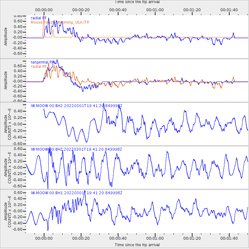
MOOW Moose Ponds, Wyoming, USA - Earthquake Result Viewer
*The percent match for this event was below the threshold and hence no stack was calculated.
| Earthquake location: |
Oaxaca, Mexico |
| Earthquake latitude/longitude: |
16.3/-96.4 |
| Earthquake time(UTC): |
2022/03/01 (060) 19:35:47 GMT |
| Earthquake Depth: |
49 km |
| Earthquake Magnitude: |
5.3 Mww |
| Earthquake Catalog/Contributor: |
NEIC PDE/us |
|
| Network: |
IW Intermountain West |
| Station: |
MOOW Moose Ponds, Wyoming, USA |
| Lat/Lon: |
43.75 N/110.74 W |
| Elevation: |
2128 m |
|
| Distance: |
29.9 deg |
| Az: |
338.902 deg |
| Baz: |
151.512 deg |
| Ray Param: |
$rayparam |
*The percent match for this event was below the threshold and hence was not used in the summary stack. |
|
| Radial Match: |
60.644848 % |
| Radial Bump: |
400 |
| Transverse Match: |
59.63638 % |
| Transverse Bump: |
400 |
| SOD ConfigId: |
26694651 |
| Insert Time: |
2022-03-15 19:45:25.735 +0000 |
| GWidth: |
2.5 |
| Max Bumps: |
400 |
| Tol: |
0.001 |
|
Signal To Noise
| Channel | StoN | STA | LTA |
| IW:MOOW:00:BHZ:20220301T19:41:20.849998Z | 1.9161541 | 4.0991767E-7 | 2.139273E-7 |
| IW:MOOW:00:BH1:20220301T19:41:20.849998Z | 0.9206293 | 3.5434792E-7 | 3.8489748E-7 |
| IW:MOOW:00:BH2:20220301T19:41:20.849998Z | 1.156006 | 3.4104525E-7 | 2.9502033E-7 |
| Arrivals |
| Ps | |
| PpPs | |
| PsPs/PpSs | |


