
AQU L'Aquila, Italy - Earthquake Result Viewer
| ||||||||||||||||||
| ||||||||||||||||||
| ||||||||||||||||||
|
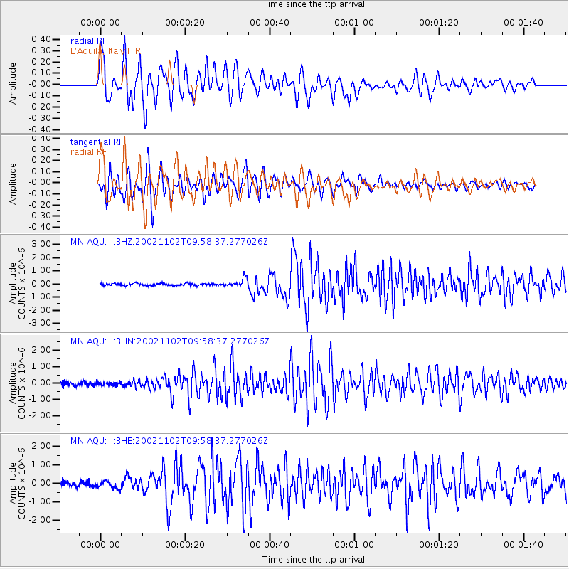
Signal To Noise
| Channel | StoN | STA | LTA |
| MN:AQU: :BHN:20021102T09:58:37.277026Z | 0.8075564 | 8.958814E-8 | 1.1093732E-7 |
| MN:AQU: :BHE:20021102T09:58:37.277026Z | 1.7924799 | 2.0109212E-7 | 1.1218655E-7 |
| MN:AQU: :BHZ:20021102T09:58:37.277026Z | 4.2390127 | 3.2819275E-7 | 7.742198E-8 |
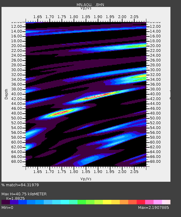
| Arrivals | |
| Ps | 5.9 SECOND |
| PpPs | 18 SECOND |
| PsPs/PpSs | 24 SECOND |

