You are here: Home > Network List > IW - Intermountain West Stations List
> Station MOOW Moose Ponds, Wyoming, USA > Earthquake Result Viewer
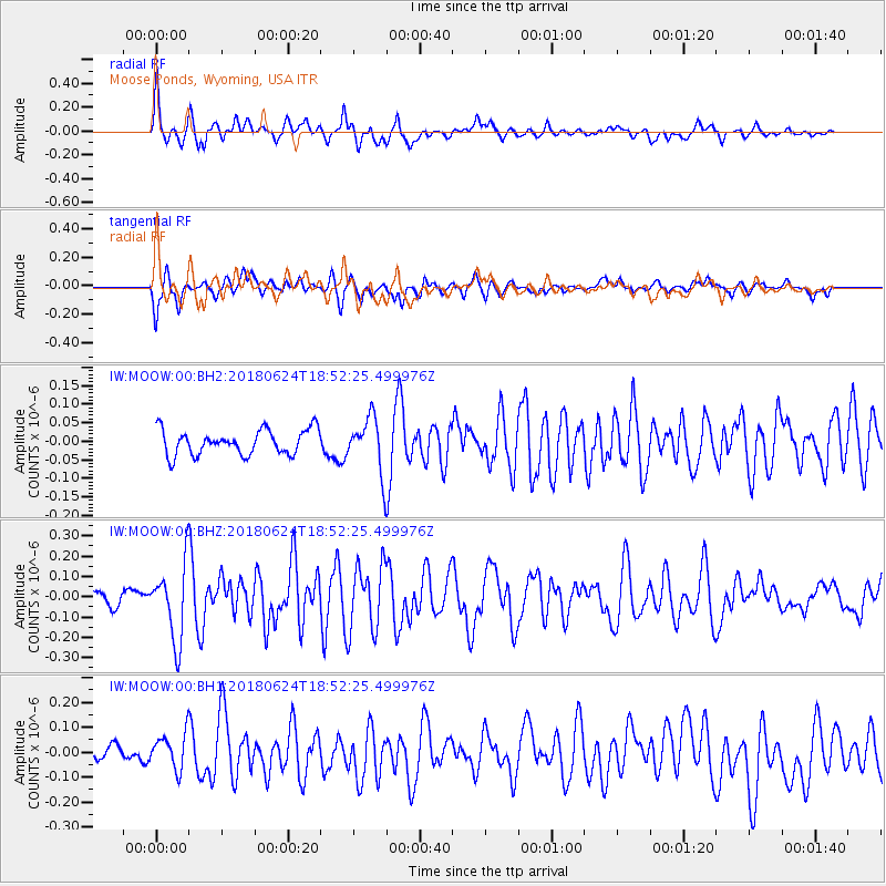
MOOW Moose Ponds, Wyoming, USA - Earthquake Result Viewer
*The percent match for this event was below the threshold and hence no stack was calculated.
| Earthquake location: |
Central East Pacific Rise |
| Earthquake latitude/longitude: |
-9.0/-108.5 |
| Earthquake time(UTC): |
2018/06/24 (175) 18:43:42 GMT |
| Earthquake Depth: |
10 km |
| Earthquake Magnitude: |
5.7 Mww |
| Earthquake Catalog/Contributor: |
NEIC PDE/us |
|
| Network: |
IW Intermountain West |
| Station: |
MOOW Moose Ponds, Wyoming, USA |
| Lat/Lon: |
43.75 N/110.74 W |
| Elevation: |
2128 m |
|
| Distance: |
52.6 deg |
| Az: |
357.988 deg |
| Baz: |
177.257 deg |
| Ray Param: |
$rayparam |
*The percent match for this event was below the threshold and hence was not used in the summary stack. |
|
| Radial Match: |
71.875305 % |
| Radial Bump: |
400 |
| Transverse Match: |
68.94505 % |
| Transverse Bump: |
400 |
| SOD ConfigId: |
2738091 |
| Insert Time: |
2018-07-08 18:48:16.052 +0000 |
| GWidth: |
2.5 |
| Max Bumps: |
400 |
| Tol: |
0.001 |
|
Signal To Noise
| Channel | StoN | STA | LTA |
| IW:MOOW:00:BHZ:20180624T18:52:25.499976Z | 5.1841903 | 1.844116E-7 | 3.557192E-8 |
| IW:MOOW:00:BH1:20180624T18:52:25.499976Z | 2.3953493 | 7.300371E-8 | 3.0477274E-8 |
| IW:MOOW:00:BH2:20180624T18:52:25.499976Z | 2.194721 | 7.365044E-8 | 3.3558E-8 |
| Arrivals |
| Ps | |
| PpPs | |
| PsPs/PpSs | |


