You are here: Home > Network List > US - United States National Seismic Network Stations List
> Station MSO Missoula, Montana, USA > Earthquake Result Viewer
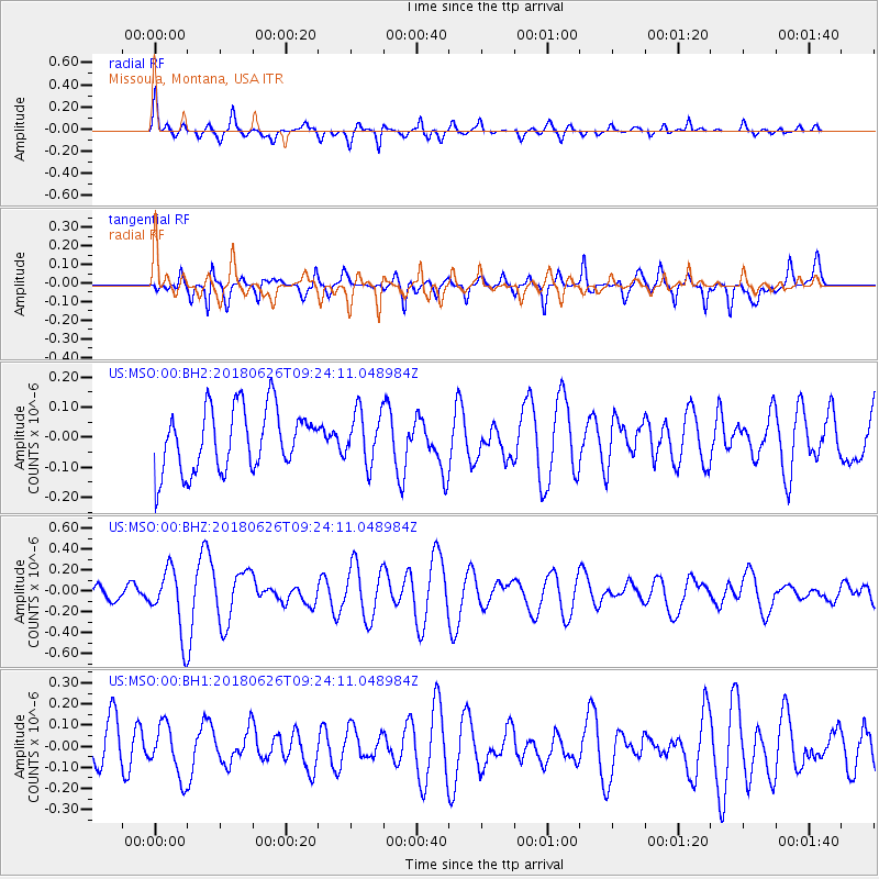
MSO Missoula, Montana, USA - Earthquake Result Viewer
*The percent match for this event was below the threshold and hence no stack was calculated.
| Earthquake location: |
Galapagos Islands, Ecuador |
| Earthquake latitude/longitude: |
-0.7/-90.9 |
| Earthquake time(UTC): |
2018/06/26 (177) 09:15:36 GMT |
| Earthquake Depth: |
10 km |
| Earthquake Magnitude: |
5.5 Mww |
| Earthquake Catalog/Contributor: |
NEIC PDE/us |
|
| Network: |
US United States National Seismic Network |
| Station: |
MSO Missoula, Montana, USA |
| Lat/Lon: |
46.83 N/113.94 W |
| Elevation: |
1264 m |
|
| Distance: |
51.4 deg |
| Az: |
339.933 deg |
| Baz: |
150.02 deg |
| Ray Param: |
$rayparam |
*The percent match for this event was below the threshold and hence was not used in the summary stack. |
|
| Radial Match: |
68.22475 % |
| Radial Bump: |
336 |
| Transverse Match: |
56.380356 % |
| Transverse Bump: |
383 |
| SOD ConfigId: |
2738091 |
| Insert Time: |
2018-07-10 09:21:32.981 +0000 |
| GWidth: |
2.5 |
| Max Bumps: |
400 |
| Tol: |
0.001 |
|
Signal To Noise
| Channel | StoN | STA | LTA |
| US:MSO:00:BHZ:20180626T09:24:11.048984Z | 4.3022895 | 3.0548625E-7 | 7.100551E-8 |
| US:MSO:00:BH1:20180626T09:24:11.048984Z | 1.4291687 | 1.215654E-7 | 8.506022E-8 |
| US:MSO:00:BH2:20180626T09:24:11.048984Z | 0.82701117 | 8.561315E-8 | 1.0352116E-7 |
| Arrivals |
| Ps | |
| PpPs | |
| PsPs/PpSs | |


