You are here: Home > Network List > GS - US Geological Survey Networks Stations List
> Station OK051 E0350 and S34600 Roads, Ralston, OK > Earthquake Result Viewer
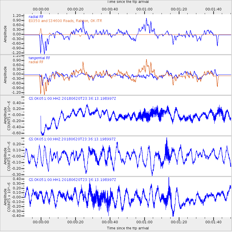
OK051 E0350 and S34600 Roads, Ralston, OK - Earthquake Result Viewer
*The percent match for this event was below the threshold and hence no stack was calculated.
| Earthquake location: |
Tonga Islands Region |
| Earthquake latitude/longitude: |
-22.4/-175.1 |
| Earthquake time(UTC): |
2018/06/20 (171) 23:23:26 GMT |
| Earthquake Depth: |
14 km |
| Earthquake Magnitude: |
5.4 Mww |
| Earthquake Catalog/Contributor: |
NEIC PDE/us |
|
| Network: |
GS US Geological Survey Networks |
| Station: |
OK051 E0350 and S34600 Roads, Ralston, OK |
| Lat/Lon: |
36.51 N/96.84 W |
| Elevation: |
263 m |
|
| Distance: |
94.1 deg |
| Az: |
52.266 deg |
| Baz: |
245.304 deg |
| Ray Param: |
$rayparam |
*The percent match for this event was below the threshold and hence was not used in the summary stack. |
|
| Radial Match: |
83.626854 % |
| Radial Bump: |
400 |
| Transverse Match: |
55.69185 % |
| Transverse Bump: |
400 |
| SOD ConfigId: |
2750733 |
| Insert Time: |
2018-07-12 03:51:44.692 +0000 |
| GWidth: |
2.5 |
| Max Bumps: |
400 |
| Tol: |
0.001 |
|
Signal To Noise
| Channel | StoN | STA | LTA |
| GS:OK051:00:HHZ:20180620T23:36:13.198997Z | 1.8321447 | 1.351212E-7 | 7.3750286E-8 |
| GS:OK051:00:HH1:20180620T23:36:13.198997Z | 0.92665267 | 2.12147E-7 | 2.2893907E-7 |
| GS:OK051:00:HH2:20180620T23:36:13.198997Z | 0.9647235 | 2.3452414E-7 | 2.4309986E-7 |
| Arrivals |
| Ps | |
| PpPs | |
| PsPs/PpSs | |


