You are here: Home > Network List > US - United States National Seismic Network Stations List
> Station HAWA Hanford, Washington, USA > Earthquake Result Viewer
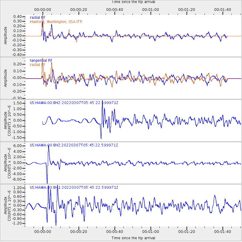
HAWA Hanford, Washington, USA - Earthquake Result Viewer
*The percent match for this event was below the threshold and hence no stack was calculated.
| Earthquake location: |
Fiji Islands Region |
| Earthquake latitude/longitude: |
-20.4/-178.4 |
| Earthquake time(UTC): |
2022/03/07 (066) 05:34:18 GMT |
| Earthquake Depth: |
582 km |
| Earthquake Magnitude: |
6.1 mww |
| Earthquake Catalog/Contributor: |
NEIC PDE/us |
|
| Network: |
US United States National Seismic Network |
| Station: |
HAWA Hanford, Washington, USA |
| Lat/Lon: |
46.39 N/119.53 W |
| Elevation: |
364 m |
|
| Distance: |
85.1 deg |
| Az: |
36.5 deg |
| Baz: |
233.733 deg |
| Ray Param: |
$rayparam |
*The percent match for this event was below the threshold and hence was not used in the summary stack. |
|
| Radial Match: |
76.56288 % |
| Radial Bump: |
400 |
| Transverse Match: |
65.41827 % |
| Transverse Bump: |
400 |
| SOD ConfigId: |
26694651 |
| Insert Time: |
2022-03-21 06:05:14.211 +0000 |
| GWidth: |
2.5 |
| Max Bumps: |
400 |
| Tol: |
0.001 |
|
Signal To Noise
| Channel | StoN | STA | LTA |
| US:HAWA:00:BHZ:20220307T05:45:22.599971Z | 8.704344 | 2.6184632E-6 | 3.008226E-7 |
| US:HAWA:00:BH1:20220307T05:45:22.599971Z | 2.5455513 | 5.257244E-7 | 2.0652675E-7 |
| US:HAWA:00:BH2:20220307T05:45:22.599971Z | 4.308908 | 6.780904E-7 | 1.5736941E-7 |
| Arrivals |
| Ps | |
| PpPs | |
| PsPs/PpSs | |


