You are here: Home > Network List > UW - Pacific Northwest Regional Seismic Network Stations List
> Station HOOD Mt Hood Meadows, OR CREST BB SMO > Earthquake Result Viewer
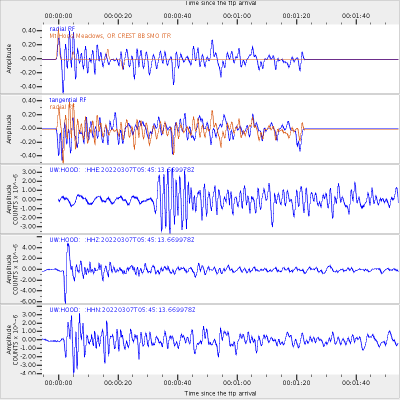
HOOD Mt Hood Meadows, OR CREST BB SMO - Earthquake Result Viewer
*The percent match for this event was below the threshold and hence no stack was calculated.
| Earthquake location: |
Fiji Islands Region |
| Earthquake latitude/longitude: |
-20.4/-178.4 |
| Earthquake time(UTC): |
2022/03/07 (066) 05:34:18 GMT |
| Earthquake Depth: |
582 km |
| Earthquake Magnitude: |
6.1 mww |
| Earthquake Catalog/Contributor: |
NEIC PDE/us |
|
| Network: |
UW Pacific Northwest Regional Seismic Network |
| Station: |
HOOD Mt Hood Meadows, OR CREST BB SMO |
| Lat/Lon: |
45.32 N/121.65 W |
| Elevation: |
1520 m |
|
| Distance: |
83.3 deg |
| Az: |
36.463 deg |
| Baz: |
232.212 deg |
| Ray Param: |
$rayparam |
*The percent match for this event was below the threshold and hence was not used in the summary stack. |
|
| Radial Match: |
71.31705 % |
| Radial Bump: |
400 |
| Transverse Match: |
66.44307 % |
| Transverse Bump: |
400 |
| SOD ConfigId: |
26694651 |
| Insert Time: |
2022-03-21 06:06:49.255 +0000 |
| GWidth: |
2.5 |
| Max Bumps: |
400 |
| Tol: |
0.001 |
|
Signal To Noise
| Channel | StoN | STA | LTA |
| UW:HOOD: :HHZ:20220307T05:45:13.669978Z | 8.811241 | 2.4428662E-6 | 2.7724428E-7 |
| UW:HOOD: :HHN:20220307T05:45:13.669978Z | 3.0773158 | 1.1066978E-6 | 3.5963092E-7 |
| UW:HOOD: :HHE:20220307T05:45:13.669978Z | 4.3731556 | 1.284677E-6 | 2.9376426E-7 |
| Arrivals |
| Ps | |
| PpPs | |
| PsPs/PpSs | |


