You are here: Home > Network List > UW - Pacific Northwest Regional Seismic Network Stations List
> Station LEBA Lebam, WA, USA > Earthquake Result Viewer
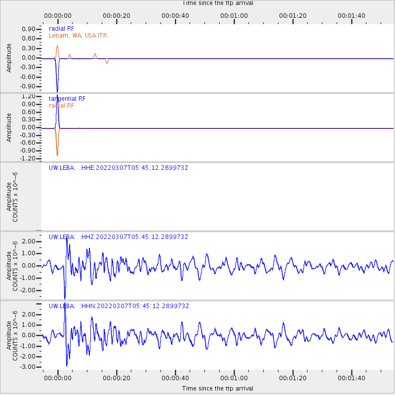
LEBA Lebam, WA, USA - Earthquake Result Viewer
*The percent match for this event was below the threshold and hence no stack was calculated.
| Earthquake location: |
Fiji Islands Region |
| Earthquake latitude/longitude: |
-20.4/-178.4 |
| Earthquake time(UTC): |
2022/03/07 (066) 05:34:18 GMT |
| Earthquake Depth: |
582 km |
| Earthquake Magnitude: |
6.1 mww |
| Earthquake Catalog/Contributor: |
NEIC PDE/us |
|
| Network: |
UW Pacific Northwest Regional Seismic Network |
| Station: |
LEBA Lebam, WA, USA |
| Lat/Lon: |
46.55 N/123.56 W |
| Elevation: |
73 m |
|
| Distance: |
83.0 deg |
| Az: |
34.661 deg |
| Baz: |
230.628 deg |
| Ray Param: |
$rayparam |
*The percent match for this event was below the threshold and hence was not used in the summary stack. |
|
| Radial Match: |
99.87398 % |
| Radial Bump: |
9 |
| Transverse Match: |
99.87397 % |
| Transverse Bump: |
9 |
| SOD ConfigId: |
26694651 |
| Insert Time: |
2022-03-21 06:07:04.242 +0000 |
| GWidth: |
2.5 |
| Max Bumps: |
400 |
| Tol: |
0.001 |
|
Signal To Noise
| Channel | StoN | STA | LTA |
| UW:LEBA: :HHZ:20220307T05:45:12.289973Z | 3.569038 | 1.0134997E-6 | 2.8397E-7 |
| UW:LEBA: :HHN:20220307T05:45:12.289973Z | 3.521103 | 1.2110361E-6 | 3.4393656E-7 |
| $trig.getChannelId() | $trig.getValue() | $trig.getSTA() | $trig.getLTA() |
| Arrivals |
| Ps | |
| PpPs | |
| PsPs/PpSs | |


