You are here: Home > Network List > US - United States National Seismic Network Stations List
> Station HAWA Hanford, Washington, USA > Earthquake Result Viewer
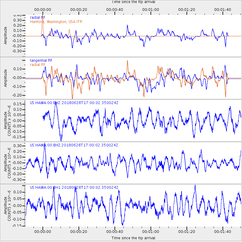
HAWA Hanford, Washington, USA - Earthquake Result Viewer
*The percent match for this event was below the threshold and hence no stack was calculated.
| Earthquake location: |
Vanuatu Islands |
| Earthquake latitude/longitude: |
-15.1/167.5 |
| Earthquake time(UTC): |
2018/06/28 (179) 16:47:49 GMT |
| Earthquake Depth: |
115 km |
| Earthquake Magnitude: |
5.4 Mww |
| Earthquake Catalog/Contributor: |
NEIC PDE/us |
|
| Network: |
US United States National Seismic Network |
| Station: |
HAWA Hanford, Washington, USA |
| Lat/Lon: |
46.39 N/119.53 W |
| Elevation: |
364 m |
|
| Distance: |
89.5 deg |
| Az: |
41.446 deg |
| Baz: |
247.453 deg |
| Ray Param: |
$rayparam |
*The percent match for this event was below the threshold and hence was not used in the summary stack. |
|
| Radial Match: |
53.32898 % |
| Radial Bump: |
400 |
| Transverse Match: |
40.18198 % |
| Transverse Bump: |
400 |
| SOD ConfigId: |
2751391 |
| Insert Time: |
2018-07-12 16:55:04.704 +0000 |
| GWidth: |
2.5 |
| Max Bumps: |
400 |
| Tol: |
0.001 |
|
Signal To Noise
| Channel | StoN | STA | LTA |
| US:HAWA:00:BHZ:20180628T17:00:02.350024Z | 2.4294796 | 1.5919863E-7 | 6.552788E-8 |
| US:HAWA:00:BH1:20180628T17:00:02.350024Z | 0.95664465 | 4.4001748E-8 | 4.5995915E-8 |
| US:HAWA:00:BH2:20180628T17:00:02.350024Z | 1.1596327 | 7.844784E-8 | 6.764887E-8 |
| Arrivals |
| Ps | |
| PpPs | |
| PsPs/PpSs | |


