You are here: Home > Network List > AV - Alaska Volcano Observatory Stations List
> Station MAPS Pakushin Southeast, Makushin Volcano, Alaska > Earthquake Result Viewer
MAPS Pakushin Southeast, Makushin Volcano, Alaska - Earthquake Result Viewer

| Earthquake location: |
Southern Sumatra, Indonesia |
| Earthquake latitude/longitude: |
-0.7/98.6 |
| Earthquake time(UTC): |
2022/03/13 (072) 21:09:21 GMT |
| Earthquake Depth: |
22 km |
| Earthquake Magnitude: |
6.7 Mww |
| Earthquake Catalog/Contributor: |
NEIC PDE/us |
|
| Network: |
AV Alaska Volcano Observatory |
| Station: |
MAPS Pakushin Southeast, Makushin Volcano, Alaska |
| Lat/Lon: |
53.81 N/166.94 W |
| Elevation: |
333 m |
|
| Distance: |
93.2 deg |
| Az: |
36.313 deg |
| Baz: |
273.195 deg |
| Ray Param: |
0.04131874 |
| Estimated Moho Depth: |
40.75 km |
| Estimated Crust Vp/Vs: |
1.97 |
| Assumed Crust Vp: |
3.943 km/s |
| Estimated Crust Vs: |
1.999 km/s |
| Estimated Crust Poisson's Ratio: |
0.33 |
|
| Radial Match: |
98.39713 % |
| Radial Bump: |
126 |
| Transverse Match: |
98.52362 % |
| Transverse Bump: |
127 |
| SOD ConfigId: |
26694651 |
| Insert Time: |
2022-03-27 21:31:13.963 +0000 |
| GWidth: |
2.5 |
| Max Bumps: |
400 |
| Tol: |
0.001 |
|
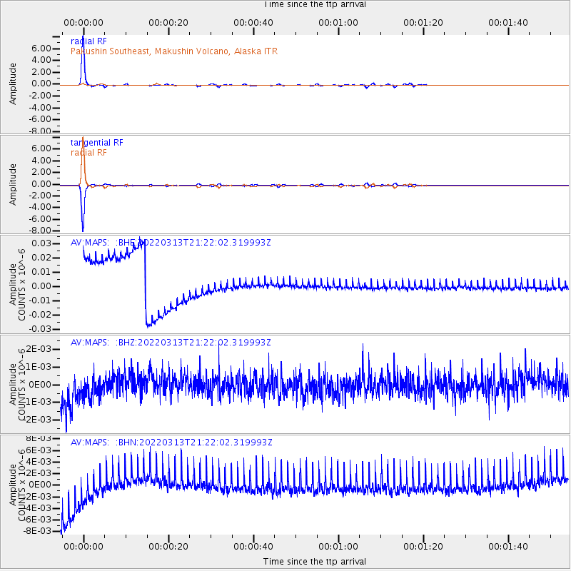
Signal To Noise
| Channel | StoN | STA | LTA |
| AV:MAPS: :BHZ:20220313T21:22:02.319993Z | 0.40268895 | 1.291611E-9 | 3.2074658E-9 |
| AV:MAPS: :BHN:20220313T21:22:02.319993Z | 0.39490116 | 6.878389E-9 | 1.7418001E-8 |
| AV:MAPS: :BHE:20220313T21:22:02.319993Z | 0.38375902 | 7.730494E-9 | 2.0144135E-8 |
| Arrivals |
| Ps | 10 SECOND |
| PpPs | 31 SECOND |
| PsPs/PpSs | 41 SECOND |


