You are here: Home > Network List > IW - Intermountain West Stations List
> Station MOOW Moose Ponds, Wyoming, USA > Earthquake Result Viewer
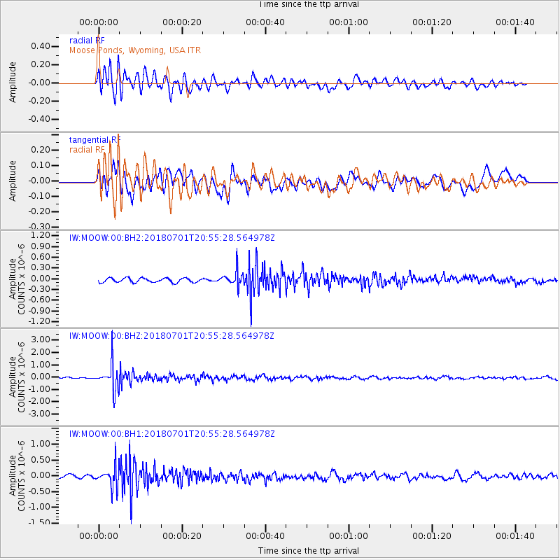
MOOW Moose Ponds, Wyoming, USA - Earthquake Result Viewer
*The percent match for this event was below the threshold and hence no stack was calculated.
| Earthquake location: |
Sea Of Okhotsk |
| Earthquake latitude/longitude: |
46.9/145.0 |
| Earthquake time(UTC): |
2018/07/01 (182) 20:45:42 GMT |
| Earthquake Depth: |
388 km |
| Earthquake Magnitude: |
5.6 Mww |
| Earthquake Catalog/Contributor: |
NEIC PDE/us |
|
| Network: |
IW Intermountain West |
| Station: |
MOOW Moose Ponds, Wyoming, USA |
| Lat/Lon: |
43.75 N/110.74 W |
| Elevation: |
2128 m |
|
| Distance: |
67.7 deg |
| Az: |
49.391 deg |
| Baz: |
314.116 deg |
| Ray Param: |
$rayparam |
*The percent match for this event was below the threshold and hence was not used in the summary stack. |
|
| Radial Match: |
59.659565 % |
| Radial Bump: |
400 |
| Transverse Match: |
54.26498 % |
| Transverse Bump: |
400 |
| SOD ConfigId: |
2752131 |
| Insert Time: |
2018-07-15 20:49:40.763 +0000 |
| GWidth: |
2.5 |
| Max Bumps: |
400 |
| Tol: |
0.001 |
|
Signal To Noise
| Channel | StoN | STA | LTA |
| IW:MOOW:00:BHZ:20180701T20:55:28.564978Z | 17.696577 | 1.0329156E-6 | 5.83681E-8 |
| IW:MOOW:00:BH1:20180701T20:55:28.564978Z | 4.7376246 | 3.2443813E-7 | 6.8481185E-8 |
| IW:MOOW:00:BH2:20180701T20:55:28.564978Z | 3.5268064 | 2.0749464E-7 | 5.8833578E-8 |
| Arrivals |
| Ps | |
| PpPs | |
| PsPs/PpSs | |


